You are here: Home > Network List > TA - USArray Transportable Network (new EarthScope stations) Stations List
> Station I23K Minto, Yukon-Koyukuk, AK, USA > Earthquake Result Viewer
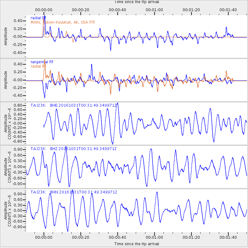
I23K Minto, Yukon-Koyukuk, AK, USA - Earthquake Result Viewer
*The percent match for this event was below the threshold and hence no stack was calculated.
| Earthquake location: |
Colombia |
| Earthquake latitude/longitude: |
3.4/-74.5 |
| Earthquake time(UTC): |
2016/10/31 (305) 00:20:11 GMT |
| Earthquake Depth: |
33 km |
| Earthquake Magnitude: |
5.6 MWW, 5.4 MWB |
| Earthquake Catalog/Contributor: |
NEIC PDE/NEIC COMCAT |
|
| Network: |
TA USArray Transportable Network (new EarthScope stations) |
| Station: |
I23K Minto, Yukon-Koyukuk, AK, USA |
| Lat/Lon: |
65.15 N/149.36 W |
| Elevation: |
149 m |
|
| Distance: |
80.6 deg |
| Az: |
335.572 deg |
| Baz: |
102.354 deg |
| Ray Param: |
$rayparam |
*The percent match for this event was below the threshold and hence was not used in the summary stack. |
|
| Radial Match: |
56.40043 % |
| Radial Bump: |
379 |
| Transverse Match: |
64.81534 % |
| Transverse Bump: |
361 |
| SOD ConfigId: |
11737051 |
| Insert Time: |
2019-04-26 00:00:05.943 +0000 |
| GWidth: |
2.5 |
| Max Bumps: |
400 |
| Tol: |
0.001 |
|
Signal To Noise
| Channel | StoN | STA | LTA |
| TA:I23K: :BHZ:20161031T00:31:49.349971Z | 2.0717895 | 5.116449E-7 | 2.4695797E-7 |
| TA:I23K: :BHN:20161031T00:31:49.349971Z | 1.891635 | 6.2908885E-7 | 3.3256356E-7 |
| TA:I23K: :BHE:20161031T00:31:49.349971Z | 1.2725018 | 4.2600863E-7 | 3.3478037E-7 |
| Arrivals |
| Ps | |
| PpPs | |
| PsPs/PpSs | |


