You are here: Home > Network List > TA - USArray Transportable Network (new EarthScope stations) Stations List
> Station MSTX Muleshoe, TX, USA > Earthquake Result Viewer
MSTX Muleshoe, TX, USA - Earthquake Result Viewer
*The percent match for this event was below the threshold and hence no stack was calculated.
| Earthquake location: |
Colombia |
| Earthquake latitude/longitude: |
3.4/-74.5 |
| Earthquake time(UTC): |
2016/10/31 (305) 00:20:11 GMT |
| Earthquake Depth: |
33 km |
| Earthquake Magnitude: |
5.6 MWW, 5.4 MWB |
| Earthquake Catalog/Contributor: |
NEIC PDE/NEIC COMCAT |
|
| Network: |
TA USArray Transportable Network (new EarthScope stations) |
| Station: |
MSTX Muleshoe, TX, USA |
| Lat/Lon: |
33.97 N/102.77 W |
| Elevation: |
1167 m |
|
| Distance: |
40.2 deg |
| Az: |
322.424 deg |
| Baz: |
132.906 deg |
| Ray Param: |
$rayparam |
*The percent match for this event was below the threshold and hence was not used in the summary stack. |
|
| Radial Match: |
49.895706 % |
| Radial Bump: |
313 |
| Transverse Match: |
74.85368 % |
| Transverse Bump: |
341 |
| SOD ConfigId: |
11737051 |
| Insert Time: |
2019-04-26 00:00:17.219 +0000 |
| GWidth: |
2.5 |
| Max Bumps: |
400 |
| Tol: |
0.001 |
|
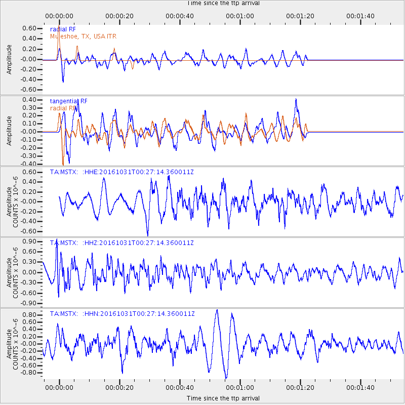
Signal To Noise
| Channel | StoN | STA | LTA |
| TA:MSTX: :HHZ:20161031T00:27:14.360011Z | 3.0041041 | 4.1180022E-7 | 1.3707921E-7 |
| TA:MSTX: :HHN:20161031T00:27:14.360011Z | 2.284564 | 2.8274317E-7 | 1.2376242E-7 |
| TA:MSTX: :HHE:20161031T00:27:14.360011Z | 2.0669882 | 3.4376134E-7 | 1.6631026E-7 |
| Arrivals |
| Ps | |
| PpPs | |
| PsPs/PpSs | |


