You are here: Home > Network List > BK - Berkeley Digital Seismograph Network Stations List
> Station HUMO Hull Mountain, OR > Earthquake Result Viewer
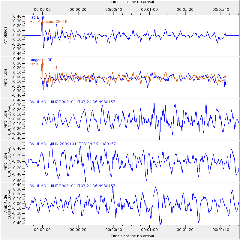
HUMO Hull Mountain, OR - Earthquake Result Viewer
*The percent match for this event was below the threshold and hence no stack was calculated.
| Earthquake location: |
Southeast Of Loyalty Islands |
| Earthquake latitude/longitude: |
-22.0/170.2 |
| Earthquake time(UTC): |
2009/10/11 (284) 03:12:13 GMT |
| Earthquake Depth: |
10 km |
| Earthquake Magnitude: |
5.7 MB, 5.5 MS, 6.0 MW, 5.9 MW |
| Earthquake Catalog/Contributor: |
WHDF/NEIC |
|
| Network: |
BK Berkeley Digital Seismograph Network |
| Station: |
HUMO Hull Mountain, OR |
| Lat/Lon: |
42.61 N/122.96 W |
| Elevation: |
555 m |
|
| Distance: |
88.9 deg |
| Az: |
42.74 deg |
| Baz: |
238.553 deg |
| Ray Param: |
$rayparam |
*The percent match for this event was below the threshold and hence was not used in the summary stack. |
|
| Radial Match: |
72.27105 % |
| Radial Bump: |
400 |
| Transverse Match: |
46.139774 % |
| Transverse Bump: |
400 |
| SOD ConfigId: |
2622 |
| Insert Time: |
2010-03-05 19:27:23.449 +0000 |
| GWidth: |
2.5 |
| Max Bumps: |
400 |
| Tol: |
0.001 |
|
Signal To Noise
| Channel | StoN | STA | LTA |
| BK:HUMO: :BHN:20091011T03:24:36.498015Z | 2.6281605 | 3.1122295E-7 | 1.1841855E-7 |
| BK:HUMO: :BHE:20091011T03:24:36.498015Z | 0.7017288 | 7.2425884E-8 | 1.0321064E-7 |
| BK:HUMO: :BHZ:20091011T03:24:36.498015Z | 1.6705259 | 1.5997261E-7 | 9.576183E-8 |
| Arrivals |
| Ps | |
| PpPs | |
| PsPs/PpSs | |


