You are here: Home > Network List > UW - Pacific Northwest Regional Seismic Network Stations List
> Station HOOD Mt Hood Meadows, OR CREST BB SMO > Earthquake Result Viewer
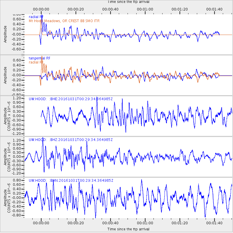
HOOD Mt Hood Meadows, OR CREST BB SMO - Earthquake Result Viewer
*The percent match for this event was below the threshold and hence no stack was calculated.
| Earthquake location: |
Colombia |
| Earthquake latitude/longitude: |
3.4/-74.5 |
| Earthquake time(UTC): |
2016/10/31 (305) 00:20:11 GMT |
| Earthquake Depth: |
33 km |
| Earthquake Magnitude: |
5.6 MWW, 5.4 MWB |
| Earthquake Catalog/Contributor: |
NEIC PDE/NEIC COMCAT |
|
| Network: |
UW Pacific Northwest Regional Seismic Network |
| Station: |
HOOD Mt Hood Meadows, OR CREST BB SMO |
| Lat/Lon: |
45.32 N/121.65 W |
| Elevation: |
1520 m |
|
| Distance: |
58.6 deg |
| Az: |
322.695 deg |
| Baz: |
120.961 deg |
| Ray Param: |
$rayparam |
*The percent match for this event was below the threshold and hence was not used in the summary stack. |
|
| Radial Match: |
65.10337 % |
| Radial Bump: |
400 |
| Transverse Match: |
48.645256 % |
| Transverse Bump: |
400 |
| SOD ConfigId: |
11737051 |
| Insert Time: |
2019-04-26 00:00:58.301 +0000 |
| GWidth: |
2.5 |
| Max Bumps: |
400 |
| Tol: |
0.001 |
|
Signal To Noise
| Channel | StoN | STA | LTA |
| UW:HOOD: :BHZ:20161031T00:29:34.364985Z | 2.7161481 | 6.02916E-7 | 2.2197463E-7 |
| UW:HOOD: :BHN:20161031T00:29:34.364985Z | 1.3741527 | 3.4653505E-7 | 2.5218088E-7 |
| UW:HOOD: :BHE:20161031T00:29:34.364985Z | 1.8842844 | 5.652806E-7 | 2.9999748E-7 |
| Arrivals |
| Ps | |
| PpPs | |
| PsPs/PpSs | |


