You are here: Home > Network List > BK - Berkeley Digital Seismograph Network Stations List
> Station HUMO Hull Mountain, OR > Earthquake Result Viewer
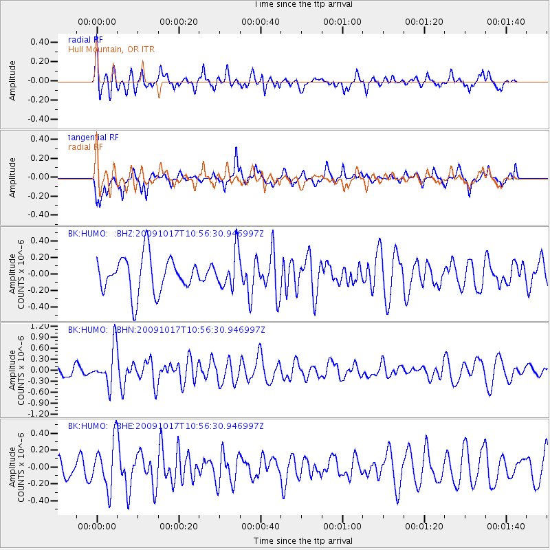
HUMO Hull Mountain, OR - Earthquake Result Viewer
*The percent match for this event was below the threshold and hence no stack was calculated.
| Earthquake location: |
Samoa Islands Region |
| Earthquake latitude/longitude: |
-16.4/-172.0 |
| Earthquake time(UTC): |
2009/10/17 (290) 10:45:26 GMT |
| Earthquake Depth: |
10 km |
| Earthquake Magnitude: |
5.7 MB, 5.3 MS, 5.7 MW, 5.7 MW |
| Earthquake Catalog/Contributor: |
WHDF/NEIC |
|
| Network: |
BK Berkeley Digital Seismograph Network |
| Station: |
HUMO Hull Mountain, OR |
| Lat/Lon: |
42.61 N/122.96 W |
| Elevation: |
555 m |
|
| Distance: |
74.0 deg |
| Az: |
35.446 deg |
| Baz: |
228.947 deg |
| Ray Param: |
$rayparam |
*The percent match for this event was below the threshold and hence was not used in the summary stack. |
|
| Radial Match: |
65.3595 % |
| Radial Bump: |
369 |
| Transverse Match: |
72.21785 % |
| Transverse Bump: |
400 |
| SOD ConfigId: |
2622 |
| Insert Time: |
2010-03-05 19:27:25.583 +0000 |
| GWidth: |
2.5 |
| Max Bumps: |
400 |
| Tol: |
0.001 |
|
Signal To Noise
| Channel | StoN | STA | LTA |
| BK:HUMO: :BHN:20091017T10:56:30.946997Z | 3.592963 | 5.273052E-7 | 1.4676054E-7 |
| BK:HUMO: :BHE:20091017T10:56:30.946997Z | 2.040147 | 2.8332394E-7 | 1.3887427E-7 |
| BK:HUMO: :BHZ:20091017T10:56:30.946997Z | 1.0025212 | 2.220735E-7 | 2.2151504E-7 |
| Arrivals |
| Ps | |
| PpPs | |
| PsPs/PpSs | |


