You are here: Home > Network List > BK - Berkeley Digital Seismograph Network Stations List
> Station HUMO Hull Mountain, OR > Earthquake Result Viewer
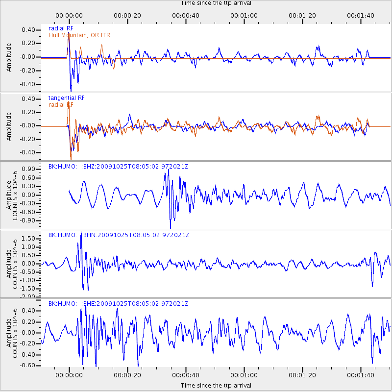
HUMO Hull Mountain, OR - Earthquake Result Viewer
*The percent match for this event was below the threshold and hence no stack was calculated.
| Earthquake location: |
South Of Fiji Islands |
| Earthquake latitude/longitude: |
-23.1/-179.2 |
| Earthquake time(UTC): |
2009/10/25 (298) 07:53:52 GMT |
| Earthquake Depth: |
418 km |
| Earthquake Magnitude: |
5.6 MB, 6.0 MW, 5.9 MW |
| Earthquake Catalog/Contributor: |
WHDF/NEIC |
|
| Network: |
BK Berkeley Digital Seismograph Network |
| Station: |
HUMO Hull Mountain, OR |
| Lat/Lon: |
42.61 N/122.96 W |
| Elevation: |
555 m |
|
| Distance: |
83.4 deg |
| Az: |
38.164 deg |
| Baz: |
230.418 deg |
| Ray Param: |
$rayparam |
*The percent match for this event was below the threshold and hence was not used in the summary stack. |
|
| Radial Match: |
71.58105 % |
| Radial Bump: |
400 |
| Transverse Match: |
66.89114 % |
| Transverse Bump: |
400 |
| SOD ConfigId: |
2622 |
| Insert Time: |
2010-03-05 19:27:27.339 +0000 |
| GWidth: |
2.5 |
| Max Bumps: |
400 |
| Tol: |
0.001 |
|
Signal To Noise
| Channel | StoN | STA | LTA |
| BK:HUMO: :BHN:20091025T08:05:02.972021Z | 3.1943457 | 7.225421E-7 | 2.2619409E-7 |
| BK:HUMO: :BHE:20091025T08:05:02.972021Z | 2.1620057 | 2.0683126E-7 | 9.566638E-8 |
| BK:HUMO: :BHZ:20091025T08:05:02.972021Z | 1.9256431 | 4.5123232E-7 | 2.3432811E-7 |
| Arrivals |
| Ps | |
| PpPs | |
| PsPs/PpSs | |


