You are here: Home > Network List > BK - Berkeley Digital Seismograph Network Stations List
> Station HUMO Hull Mountain, OR > Earthquake Result Viewer
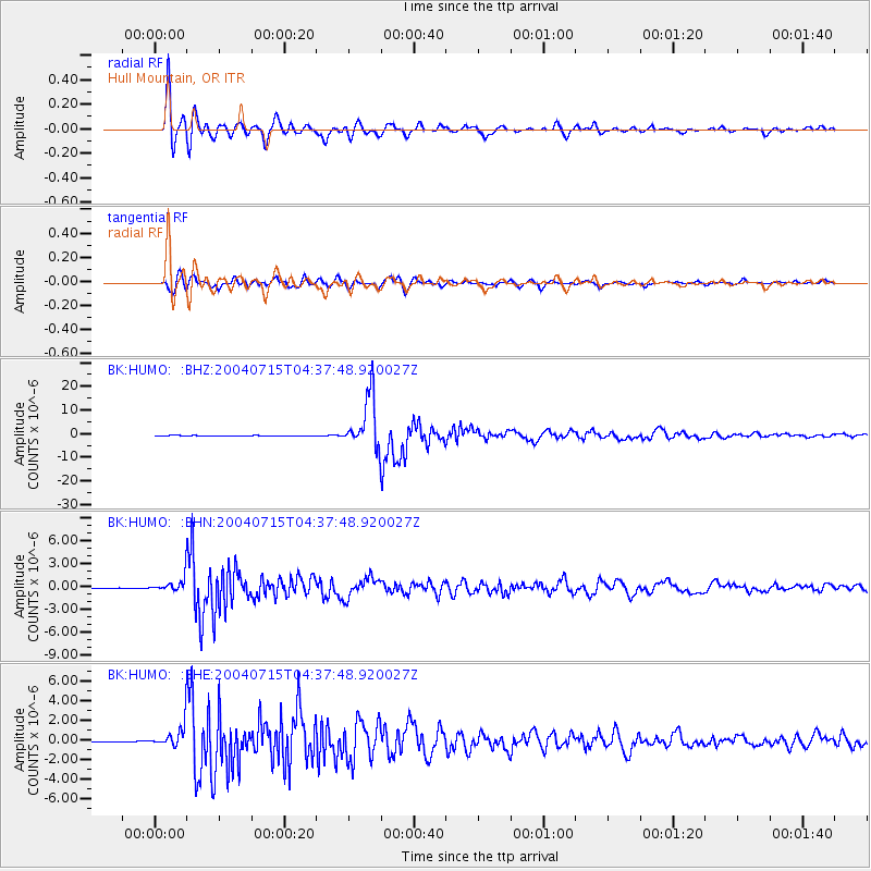
HUMO Hull Mountain, OR - Earthquake Result Viewer
*The percent match for this event was below the threshold and hence no stack was calculated.
| Earthquake location: |
Fiji Islands Region |
| Earthquake latitude/longitude: |
-17.6/-178.6 |
| Earthquake time(UTC): |
2004/07/15 (197) 04:27:12 GMT |
| Earthquake Depth: |
560 km |
| Earthquake Magnitude: |
5.5 MB |
| Earthquake Catalog/Contributor: |
WHDF/NEIC |
|
| Network: |
BK Berkeley Digital Seismograph Network |
| Station: |
HUMO Hull Mountain, OR |
| Lat/Lon: |
42.61 N/122.96 W |
| Elevation: |
555 m |
|
| Distance: |
78.8 deg |
| Az: |
38.419 deg |
| Baz: |
233.382 deg |
| Ray Param: |
$rayparam |
*The percent match for this event was below the threshold and hence was not used in the summary stack. |
|
| Radial Match: |
95.19638 % |
| Radial Bump: |
400 |
| Transverse Match: |
92.160995 % |
| Transverse Bump: |
400 |
| SOD ConfigId: |
2459 |
| Insert Time: |
2010-03-05 19:27:34.788 +0000 |
| GWidth: |
2.5 |
| Max Bumps: |
400 |
| Tol: |
0.001 |
|
Signal To Noise
| Channel | StoN | STA | LTA |
| BK:HUMO: :BHN:20040715T04:37:48.920027Z | 32.995556 | 1.08121E-6 | 3.276835E-8 |
| BK:HUMO: :BHE:20040715T04:37:48.920027Z | 38.308193 | 1.3396202E-6 | 3.496955E-8 |
| BK:HUMO: :BHZ:20040715T04:37:48.920027Z | 54.501892 | 3.4331324E-6 | 6.299107E-8 |
| Arrivals |
| Ps | |
| PpPs | |
| PsPs/PpSs | |


