You are here: Home > Network List > TA - USArray Transportable Network (new EarthScope stations) Stations List
> Station M31M Drury Creek, Yukon, CA > Earthquake Result Viewer
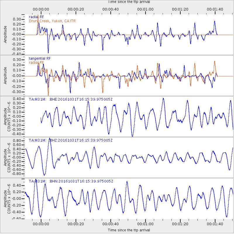
M31M Drury Creek, Yukon, CA - Earthquake Result Viewer
*The percent match for this event was below the threshold and hence no stack was calculated.
| Earthquake location: |
Owen Fracture Zone Region |
| Earthquake latitude/longitude: |
20.9/61.7 |
| Earthquake time(UTC): |
2016/10/31 (305) 16:02:43 GMT |
| Earthquake Depth: |
0.0 km |
| Earthquake Magnitude: |
5.4 |
| Earthquake Catalog/Contributor: |
NEIC PDE/us |
|
| Network: |
TA USArray Transportable Network (new EarthScope stations) |
| Station: |
M31M Drury Creek, Yukon, CA |
| Lat/Lon: |
62.20 N/134.39 W |
| Elevation: |
639 m |
|
| Distance: |
96.2 deg |
| Az: |
7.509 deg |
| Baz: |
344.891 deg |
| Ray Param: |
$rayparam |
*The percent match for this event was below the threshold and hence was not used in the summary stack. |
|
| Radial Match: |
50.32554 % |
| Radial Bump: |
400 |
| Transverse Match: |
64.32593 % |
| Transverse Bump: |
400 |
| SOD ConfigId: |
11737051 |
| Insert Time: |
2019-04-26 00:06:02.829 +0000 |
| GWidth: |
2.5 |
| Max Bumps: |
400 |
| Tol: |
0.001 |
|
Signal To Noise
| Channel | StoN | STA | LTA |
| TA:M31M: :BHZ:20161031T16:15:39.975005Z | 2.3116632 | 5.686533E-7 | 2.4599314E-7 |
| TA:M31M: :BHN:20161031T16:15:39.975005Z | 1.5064307 | 3.2747218E-7 | 2.1738283E-7 |
| TA:M31M: :BHE:20161031T16:15:39.975005Z | 0.92695385 | 1.1624156E-7 | 1.2540167E-7 |
| Arrivals |
| Ps | |
| PpPs | |
| PsPs/PpSs | |


