You are here: Home > Network List > BK - Berkeley Digital Seismograph Network Stations List
> Station HUMO Hull Mountain, OR > Earthquake Result Viewer
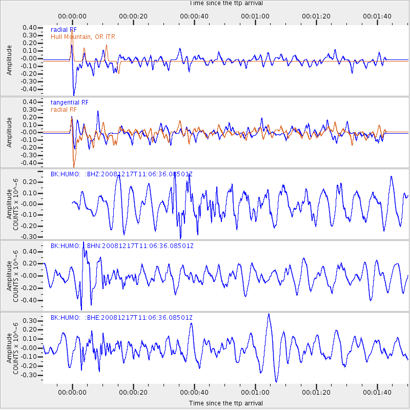
HUMO Hull Mountain, OR - Earthquake Result Viewer
*The percent match for this event was below the threshold and hence no stack was calculated.
| Earthquake location: |
Fiji Islands Region |
| Earthquake latitude/longitude: |
-17.7/-178.4 |
| Earthquake time(UTC): |
2008/12/17 (352) 10:55:59 GMT |
| Earthquake Depth: |
530 km |
| Earthquake Magnitude: |
5.8 MW, 5.2 MB, 5.8 MW |
| Earthquake Catalog/Contributor: |
WHDF/NEIC |
|
| Network: |
BK Berkeley Digital Seismograph Network |
| Station: |
HUMO Hull Mountain, OR |
| Lat/Lon: |
42.61 N/122.96 W |
| Elevation: |
555 m |
|
| Distance: |
78.8 deg |
| Az: |
38.295 deg |
| Baz: |
233.127 deg |
| Ray Param: |
$rayparam |
*The percent match for this event was below the threshold and hence was not used in the summary stack. |
|
| Radial Match: |
62.26773 % |
| Radial Bump: |
400 |
| Transverse Match: |
60.98053 % |
| Transverse Bump: |
400 |
| SOD ConfigId: |
2658 |
| Insert Time: |
2010-03-05 19:27:55.176 +0000 |
| GWidth: |
2.5 |
| Max Bumps: |
400 |
| Tol: |
0.001 |
|
Signal To Noise
| Channel | StoN | STA | LTA |
| BK:HUMO: :BHN:20081217T11:06:36.08501Z | 3.1636674 | 2.895652E-7 | 9.1528335E-8 |
| BK:HUMO: :BHE:20081217T11:06:36.08501Z | 1.0711057 | 1.1590502E-7 | 1.0821063E-7 |
| BK:HUMO: :BHZ:20081217T11:06:36.08501Z | 0.98544306 | 1.1542752E-7 | 1.17132615E-7 |
| Arrivals |
| Ps | |
| PpPs | |
| PsPs/PpSs | |


