You are here: Home > Network List > BK - Berkeley Digital Seismograph Network Stations List
> Station HUMO Hull Mountain, OR > Earthquake Result Viewer
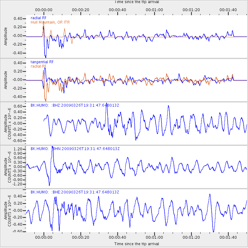
HUMO Hull Mountain, OR - Earthquake Result Viewer
*The percent match for this event was below the threshold and hence no stack was calculated.
| Earthquake location: |
Northwest Of Ryukyu Islands |
| Earthquake latitude/longitude: |
27.4/126.7 |
| Earthquake time(UTC): |
2009/03/26 (085) 19:19:59 GMT |
| Earthquake Depth: |
160 km |
| Earthquake Magnitude: |
5.6 MB, 5.9 MW, 5.9 MW |
| Earthquake Catalog/Contributor: |
WHDF/NEIC |
|
| Network: |
BK Berkeley Digital Seismograph Network |
| Station: |
HUMO Hull Mountain, OR |
| Lat/Lon: |
42.61 N/122.96 W |
| Elevation: |
555 m |
|
| Distance: |
85.4 deg |
| Az: |
43.988 deg |
| Baz: |
303.254 deg |
| Ray Param: |
$rayparam |
*The percent match for this event was below the threshold and hence was not used in the summary stack. |
|
| Radial Match: |
69.87792 % |
| Radial Bump: |
400 |
| Transverse Match: |
55.140514 % |
| Transverse Bump: |
400 |
| SOD ConfigId: |
2658 |
| Insert Time: |
2010-03-05 19:28:05.243 +0000 |
| GWidth: |
2.5 |
| Max Bumps: |
400 |
| Tol: |
0.001 |
|
Signal To Noise
| Channel | StoN | STA | LTA |
| BK:HUMO: :BHN:20090326T19:31:47.648013Z | 3.2984436 | 7.054398E-7 | 2.138705E-7 |
| BK:HUMO: :BHE:20090326T19:31:47.648013Z | 2.3806965 | 2.7099208E-7 | 1.13828904E-7 |
| BK:HUMO: :BHZ:20090326T19:31:47.648013Z | 1.6223418 | 2.7919327E-7 | 1.7209277E-7 |
| Arrivals |
| Ps | |
| PpPs | |
| PsPs/PpSs | |


