You are here: Home > Network List > GS - US Geological Survey Networks Stations List
> Station KAN10 Keim Farm, Anthony, KS, USA > Earthquake Result Viewer
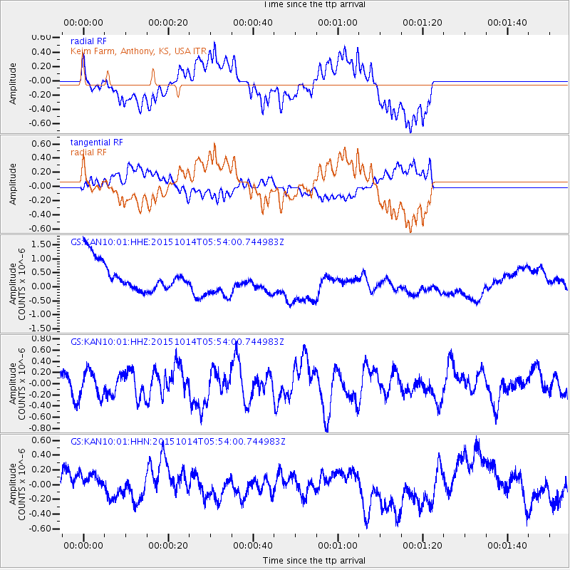
KAN10 Keim Farm, Anthony, KS, USA - Earthquake Result Viewer
*The percent match for this event was below the threshold and hence no stack was calculated.
| Earthquake location: |
East Of Kuril Islands |
| Earthquake latitude/longitude: |
48.9/156.2 |
| Earthquake time(UTC): |
2015/10/14 (287) 05:43:07 GMT |
| Earthquake Depth: |
6.0 km |
| Earthquake Magnitude: |
5.6 MB, 5.9 MWB |
| Earthquake Catalog/Contributor: |
NEIC PDE/NEIC COMCAT |
|
| Network: |
GS US Geological Survey Networks |
| Station: |
KAN10 Keim Farm, Anthony, KS, USA |
| Lat/Lon: |
37.12 N/98.10 W |
| Elevation: |
417 m |
|
| Distance: |
72.0 deg |
| Az: |
54.013 deg |
| Baz: |
318.035 deg |
| Ray Param: |
$rayparam |
*The percent match for this event was below the threshold and hence was not used in the summary stack. |
|
| Radial Match: |
56.136158 % |
| Radial Bump: |
400 |
| Transverse Match: |
60.838223 % |
| Transverse Bump: |
400 |
| SOD ConfigId: |
1259291 |
| Insert Time: |
2015-10-28 06:49:11.828 +0000 |
| GWidth: |
2.5 |
| Max Bumps: |
400 |
| Tol: |
0.001 |
|
Signal To Noise
| Channel | StoN | STA | LTA |
| GS:KAN10:01:HHZ:20151014T05:54:00.744983Z | 1.5321764 | 2.2571798E-7 | 1.4731854E-7 |
| GS:KAN10:01:HHN:20151014T05:54:00.744983Z | 1.130212 | 2.808494E-7 | 2.484927E-7 |
| GS:KAN10:01:HHE:20151014T05:54:00.744983Z | 1.1914256 | 6.1471223E-7 | 5.159468E-7 |
| Arrivals |
| Ps | |
| PpPs | |
| PsPs/PpSs | |


