You are here: Home > Network List > UW - Pacific Northwest Regional Seismic Network Stations List
> Station FISH Seaside, OR, USA > Earthquake Result Viewer
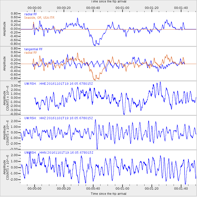
FISH Seaside, OR, USA - Earthquake Result Viewer
*The percent match for this event was below the threshold and hence no stack was calculated.
| Earthquake location: |
New Britain Region, P.N.G. |
| Earthquake latitude/longitude: |
-6.1/148.6 |
| Earthquake time(UTC): |
2016/11/01 (306) 19:03:28 GMT |
| Earthquake Depth: |
35 km |
| Earthquake Magnitude: |
5.9 MWB |
| Earthquake Catalog/Contributor: |
NEIC PDE/NEIC COMCAT |
|
| Network: |
UW Pacific Northwest Regional Seismic Network |
| Station: |
FISH Seaside, OR, USA |
| Lat/Lon: |
45.93 N/123.56 W |
| Elevation: |
325 m |
|
| Distance: |
92.8 deg |
| Az: |
44.289 deg |
| Baz: |
264.193 deg |
| Ray Param: |
$rayparam |
*The percent match for this event was below the threshold and hence was not used in the summary stack. |
|
| Radial Match: |
30.696184 % |
| Radial Bump: |
400 |
| Transverse Match: |
46.06321 % |
| Transverse Bump: |
400 |
| SOD ConfigId: |
11737051 |
| Insert Time: |
2019-04-26 00:11:54.055 +0000 |
| GWidth: |
2.5 |
| Max Bumps: |
400 |
| Tol: |
0.001 |
|
Signal To Noise
| Channel | StoN | STA | LTA |
| UW:FISH: :HHZ:20161101T19:16:05.678015Z | 0.9206333 | 7.0393503E-7 | 7.6462044E-7 |
| UW:FISH: :HHN:20161101T19:16:05.678015Z | 1.3531631 | 1.4655844E-6 | 1.0830804E-6 |
| UW:FISH: :HHE:20161101T19:16:05.678015Z | 1.832009 | 2.1167825E-6 | 1.1554433E-6 |
| Arrivals |
| Ps | |
| PpPs | |
| PsPs/PpSs | |


