You are here: Home > Network List > BK - Berkeley Digital Seismograph Network Stations List
> Station HUMO Hull Mountain, OR > Earthquake Result Viewer
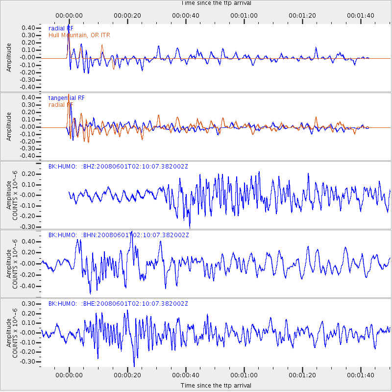
HUMO Hull Mountain, OR - Earthquake Result Viewer
*The percent match for this event was below the threshold and hence no stack was calculated.
| Earthquake location: |
Philippine Islands Region |
| Earthquake latitude/longitude: |
20.1/121.4 |
| Earthquake time(UTC): |
2008/06/01 (153) 01:57:24 GMT |
| Earthquake Depth: |
35 km |
| Earthquake Magnitude: |
6.0 MB, 6.2 MS, 6.3 MW, 6.2 MW |
| Earthquake Catalog/Contributor: |
WHDF/NEIC |
|
| Network: |
BK Berkeley Digital Seismograph Network |
| Station: |
HUMO Hull Mountain, OR |
| Lat/Lon: |
42.61 N/122.96 W |
| Elevation: |
555 m |
|
| Distance: |
94.0 deg |
| Az: |
41.837 deg |
| Baz: |
301.899 deg |
| Ray Param: |
$rayparam |
*The percent match for this event was below the threshold and hence was not used in the summary stack. |
|
| Radial Match: |
71.48308 % |
| Radial Bump: |
400 |
| Transverse Match: |
63.169228 % |
| Transverse Bump: |
400 |
| SOD ConfigId: |
2504 |
| Insert Time: |
2010-03-05 19:28:28.113 +0000 |
| GWidth: |
2.5 |
| Max Bumps: |
400 |
| Tol: |
0.001 |
|
Signal To Noise
| Channel | StoN | STA | LTA |
| BK:HUMO: :BHN:20080601T02:10:07.382002Z | 4.288288 | 2.2174943E-7 | 5.171048E-8 |
| BK:HUMO: :BHE:20080601T02:10:07.382002Z | 1.1726395 | 4.262743E-8 | 3.6351693E-8 |
| BK:HUMO: :BHZ:20080601T02:10:07.382002Z | 1.7955897 | 6.0174074E-8 | 3.351215E-8 |
| Arrivals |
| Ps | |
| PpPs | |
| PsPs/PpSs | |


