You are here: Home > Network List > BK - Berkeley Digital Seismograph Network Stations List
> Station HUMO Hull Mountain, OR > Earthquake Result Viewer
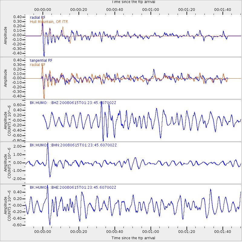
HUMO Hull Mountain, OR - Earthquake Result Viewer
*The percent match for this event was below the threshold and hence no stack was calculated.
| Earthquake location: |
Fiji Islands Region |
| Earthquake latitude/longitude: |
-17.7/-179.7 |
| Earthquake time(UTC): |
2008/06/15 (167) 01:13:11 GMT |
| Earthquake Depth: |
611 km |
| Earthquake Magnitude: |
5.5 MB, 5.9 MW, 5.9 MW |
| Earthquake Catalog/Contributor: |
WHDF/NEIC |
|
| Network: |
BK Berkeley Digital Seismograph Network |
| Station: |
HUMO Hull Mountain, OR |
| Lat/Lon: |
42.61 N/122.96 W |
| Elevation: |
555 m |
|
| Distance: |
79.6 deg |
| Az: |
38.903 deg |
| Baz: |
234.166 deg |
| Ray Param: |
$rayparam |
*The percent match for this event was below the threshold and hence was not used in the summary stack. |
|
| Radial Match: |
68.89981 % |
| Radial Bump: |
400 |
| Transverse Match: |
59.28026 % |
| Transverse Bump: |
400 |
| SOD ConfigId: |
2504 |
| Insert Time: |
2010-03-05 19:28:33.524 +0000 |
| GWidth: |
2.5 |
| Max Bumps: |
400 |
| Tol: |
0.001 |
|
Signal To Noise
| Channel | StoN | STA | LTA |
| BK:HUMO: :BHN:20080615T01:23:45.607002Z | 5.474044 | 1.0064299E-6 | 1.8385492E-7 |
| BK:HUMO: :BHE:20080615T01:23:45.607002Z | 2.5593765 | 3.0740188E-7 | 1.2010811E-7 |
| BK:HUMO: :BHZ:20080615T01:23:45.607002Z | 2.0477283 | 3.7589467E-7 | 1.8356667E-7 |
| Arrivals |
| Ps | |
| PpPs | |
| PsPs/PpSs | |


