You are here: Home > Network List > IU - Global Seismograph Network (GSN - IRIS/USGS) Stations List
> Station RAR Rarotonga, Cook Islands > Earthquake Result Viewer
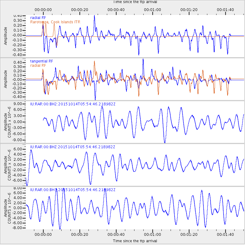
RAR Rarotonga, Cook Islands - Earthquake Result Viewer
*The percent match for this event was below the threshold and hence no stack was calculated.
| Earthquake location: |
East Of Kuril Islands |
| Earthquake latitude/longitude: |
48.9/156.2 |
| Earthquake time(UTC): |
2015/10/14 (287) 05:43:07 GMT |
| Earthquake Depth: |
6.0 km |
| Earthquake Magnitude: |
5.6 MB, 5.9 MWB |
| Earthquake Catalog/Contributor: |
NEIC PDE/NEIC COMCAT |
|
| Network: |
IU Global Seismograph Network (GSN - IRIS/USGS) |
| Station: |
RAR Rarotonga, Cook Islands |
| Lat/Lon: |
21.21 S/159.77 W |
| Elevation: |
28 m |
|
| Distance: |
80.0 deg |
| Az: |
138.862 deg |
| Baz: |
332.243 deg |
| Ray Param: |
$rayparam |
*The percent match for this event was below the threshold and hence was not used in the summary stack. |
|
| Radial Match: |
59.420994 % |
| Radial Bump: |
400 |
| Transverse Match: |
47.26217 % |
| Transverse Bump: |
295 |
| SOD ConfigId: |
1259291 |
| Insert Time: |
2015-10-28 06:50:57.381 +0000 |
| GWidth: |
2.5 |
| Max Bumps: |
400 |
| Tol: |
0.001 |
|
Signal To Noise
| Channel | StoN | STA | LTA |
| IU:RAR:00:BHZ:20151014T05:54:46.218982Z | 0.4768666 | 1.4247528E-6 | 2.9877388E-6 |
| IU:RAR:00:BH1:20151014T05:54:46.218982Z | 1.2818658 | 2.7569579E-6 | 2.150738E-6 |
| IU:RAR:00:BH2:20151014T05:54:46.218982Z | 1.9383379 | 5.6791823E-6 | 2.9299238E-6 |
| Arrivals |
| Ps | |
| PpPs | |
| PsPs/PpSs | |


