You are here: Home > Network List > US - United States National Seismic Network Stations List
> Station HAWA Hanford, Washington, USA > Earthquake Result Viewer
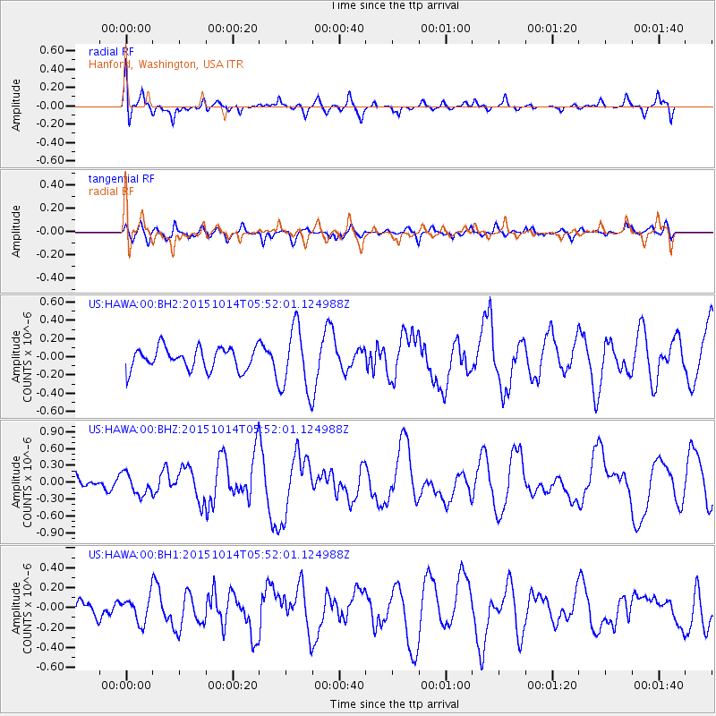
HAWA Hanford, Washington, USA - Earthquake Result Viewer
*The percent match for this event was below the threshold and hence no stack was calculated.
| Earthquake location: |
East Of Kuril Islands |
| Earthquake latitude/longitude: |
48.9/156.2 |
| Earthquake time(UTC): |
2015/10/14 (287) 05:43:07 GMT |
| Earthquake Depth: |
6.0 km |
| Earthquake Magnitude: |
5.6 MB, 5.9 MWB |
| Earthquake Catalog/Contributor: |
NEIC PDE/NEIC COMCAT |
|
| Network: |
US United States National Seismic Network |
| Station: |
HAWA Hanford, Washington, USA |
| Lat/Lon: |
46.39 N/119.53 W |
| Elevation: |
364 m |
|
| Distance: |
54.0 deg |
| Az: |
58.354 deg |
| Baz: |
305.667 deg |
| Ray Param: |
$rayparam |
*The percent match for this event was below the threshold and hence was not used in the summary stack. |
|
| Radial Match: |
56.194 % |
| Radial Bump: |
400 |
| Transverse Match: |
45.23208 % |
| Transverse Bump: |
387 |
| SOD ConfigId: |
1259291 |
| Insert Time: |
2015-10-28 06:53:59.597 +0000 |
| GWidth: |
2.5 |
| Max Bumps: |
400 |
| Tol: |
0.001 |
|
Signal To Noise
| Channel | StoN | STA | LTA |
| US:HAWA:00:BHZ:20151014T05:52:01.124988Z | 0.892074 | 1.8772116E-7 | 2.1043228E-7 |
| US:HAWA:00:BH1:20151014T05:52:01.124988Z | 1.1759986 | 1.297246E-7 | 1.1031017E-7 |
| US:HAWA:00:BH2:20151014T05:52:01.124988Z | 2.9421904 | 3.525997E-7 | 1.1984258E-7 |
| Arrivals |
| Ps | |
| PpPs | |
| PsPs/PpSs | |


