
KCC Kaiser Creek, CA - Earthquake Result Viewer
| ||||||||||||||||||
| ||||||||||||||||||
| ||||||||||||||||||
|
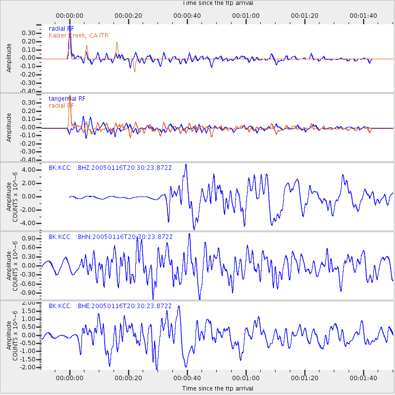
Signal To Noise
| Channel | StoN | STA | LTA |
| BK:KCC: :BHN:20050116T20:30:23.872Z | 1.2803214 | 1.7079978E-7 | 1.3340383E-7 |
| BK:KCC: :BHE:20050116T20:30:23.872Z | 2.8760595 | 3.726212E-7 | 1.2955962E-7 |
| BK:KCC: :BHZ:20050116T20:30:23.872Z | 9.067717 | 1.202715E-6 | 1.3263703E-7 |
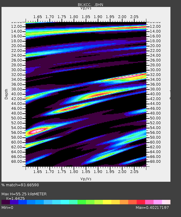
| Arrivals | |
| Ps | 5.8 SECOND |
| PpPs | 23 SECOND |
| PsPs/PpSs | 28 SECOND |

