KCC Kaiser Creek, CA - Earthquake Result Viewer
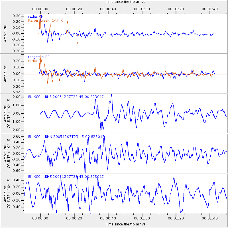
Earthquake location: Kermadec Islands, New Zealand
Earthquake latitude/longitude: -30.0/-177.6
Earthquake time(UTC): 2005/12/07 (341) 23:32:51 GMT
Earthquake Depth: 21 km
Earthquake Magnitude: 6.0 MB, 6.4 MS, 6.4 MW, 6.3 MW
Earthquake Catalog/Contributor: WHDF/NEIC
Network: BK Berkeley Digital Seismograph Network
Station: KCC Kaiser Creek, CA
Lat/Lon: 37.32 N/119.32 W
Elevation: 888 m
Distance: 86.4 deg
Az: 42.822 deg
Baz: 227.695 deg
Ray Param: 0.044056036
Estimated Moho Depth: 19.25 km
Estimated Crust Vp/Vs: 1.90
Assumed Crust Vp: 6.291 km/s
Estimated Crust Vs: 3.316 km/s
Estimated Crust Poisson's Ratio: 0.31
Radial Match: 81.56918 %
Radial Bump: 400
Transverse Match: 68.63522 %
Transverse Bump: 400
SOD ConfigId: 2422
Insert Time: 2010-03-05 19:31:02.263 +0000
GWidth: 2.5
Max Bumps: 400
Tol: 0.001

Signal To Noise

ChannelStoNSTALTA
BK:KCC: :BHN:20051207T23:45:00.82301Z1.56686592.0003365E-71.2766482E-7
BK:KCC: :BHE:20051207T23:45:00.82301Z0.80080961.5085392E-71.8837676E-7
BK:KCC: :BHZ:20051207T23:45:00.82301Z2.17116386.931465E-73.1925111E-7
Arrivals
Ps2.8 SECOND
PpPs8.7 SECOND
PsPs/PpSs11 SECOND