You are here: Home > Network List > IU - Global Seismograph Network (GSN - IRIS/USGS) Stations List
> Station PMG Port Moresby, New Guinea > Earthquake Result Viewer
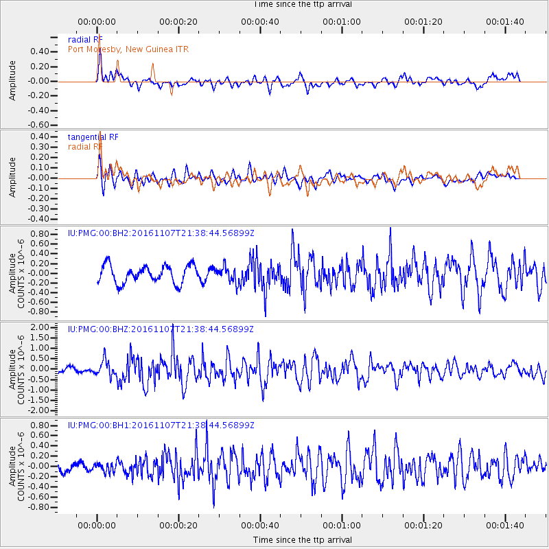
PMG Port Moresby, New Guinea - Earthquake Result Viewer
*The percent match for this event was below the threshold and hence no stack was calculated.
| Earthquake location: |
Southwest Of Sumatra, Indonesia |
| Earthquake latitude/longitude: |
-8.1/104.8 |
| Earthquake time(UTC): |
2016/11/07 (312) 21:31:24 GMT |
| Earthquake Depth: |
10 km |
| Earthquake Magnitude: |
5.6 MWB |
| Earthquake Catalog/Contributor: |
NEIC PDE/NEIC COMCAT |
|
| Network: |
IU Global Seismograph Network (GSN - IRIS/USGS) |
| Station: |
PMG Port Moresby, New Guinea |
| Lat/Lon: |
9.40 S/147.16 E |
| Elevation: |
90 m |
|
| Distance: |
41.8 deg |
| Az: |
94.991 deg |
| Baz: |
268.273 deg |
| Ray Param: |
$rayparam |
*The percent match for this event was below the threshold and hence was not used in the summary stack. |
|
| Radial Match: |
66.16071 % |
| Radial Bump: |
400 |
| Transverse Match: |
59.623528 % |
| Transverse Bump: |
400 |
| SOD ConfigId: |
11737051 |
| Insert Time: |
2019-04-26 00:25:27.447 +0000 |
| GWidth: |
2.5 |
| Max Bumps: |
400 |
| Tol: |
0.001 |
|
Signal To Noise
| Channel | StoN | STA | LTA |
| IU:PMG:00:BHZ:20161107T21:38:44.56899Z | 2.3123147 | 3.8220534E-7 | 1.6529123E-7 |
| IU:PMG:00:BH1:20161107T21:38:44.56899Z | 0.47125414 | 8.3637985E-8 | 1.7747958E-7 |
| IU:PMG:00:BH2:20161107T21:38:44.56899Z | 0.75093484 | 1.3673016E-7 | 1.8207994E-7 |
| Arrivals |
| Ps | |
| PpPs | |
| PsPs/PpSs | |


