You are here: Home > Network List > TJ - Tajikistan National Seismic Network Stations List
> Station GARM Garm, Tajikistan > Earthquake Result Viewer
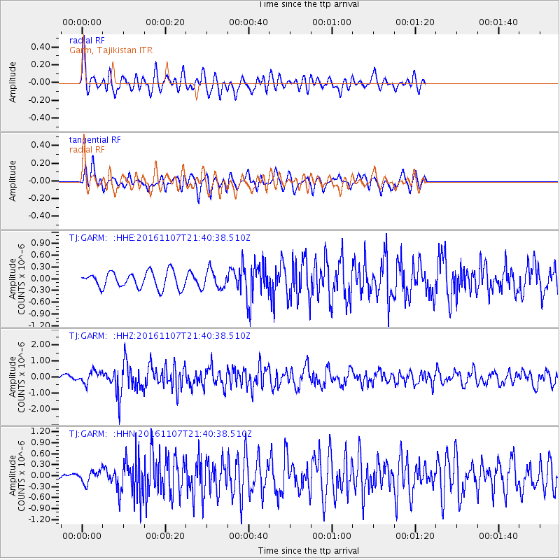
GARM Garm, Tajikistan - Earthquake Result Viewer
*The percent match for this event was below the threshold and hence no stack was calculated.
| Earthquake location: |
Southwest Of Sumatra, Indonesia |
| Earthquake latitude/longitude: |
-8.1/104.8 |
| Earthquake time(UTC): |
2016/11/07 (312) 21:31:24 GMT |
| Earthquake Depth: |
10 km |
| Earthquake Magnitude: |
5.6 MWB |
| Earthquake Catalog/Contributor: |
NEIC PDE/NEIC COMCAT |
|
| Network: |
TJ Tajikistan National Seismic Network |
| Station: |
GARM Garm, Tajikistan |
| Lat/Lon: |
39.00 N/70.32 E |
| Elevation: |
1305 m |
|
| Distance: |
56.8 deg |
| Az: |
328.161 deg |
| Baz: |
137.912 deg |
| Ray Param: |
$rayparam |
*The percent match for this event was below the threshold and hence was not used in the summary stack. |
|
| Radial Match: |
65.677734 % |
| Radial Bump: |
400 |
| Transverse Match: |
66.31245 % |
| Transverse Bump: |
400 |
| SOD ConfigId: |
11737051 |
| Insert Time: |
2019-04-26 00:26:29.688 +0000 |
| GWidth: |
2.5 |
| Max Bumps: |
400 |
| Tol: |
0.001 |
|
Signal To Noise
| Channel | StoN | STA | LTA |
| TJ:GARM: :HHZ:20161107T21:40:38.510Z | 2.096115 | 3.9000017E-7 | 1.8605856E-7 |
| TJ:GARM: :HHN:20161107T21:40:38.510Z | 1.3293899 | 1.720475E-7 | 1.294184E-7 |
| TJ:GARM: :HHE:20161107T21:40:38.510Z | 1.1938492 | 2.4644402E-7 | 2.064281E-7 |
| Arrivals |
| Ps | |
| PpPs | |
| PsPs/PpSs | |


