
KCC Kaiser Creek, CA - Earthquake Result Viewer
| ||||||||||||||||||
| ||||||||||||||||||
| ||||||||||||||||||
|
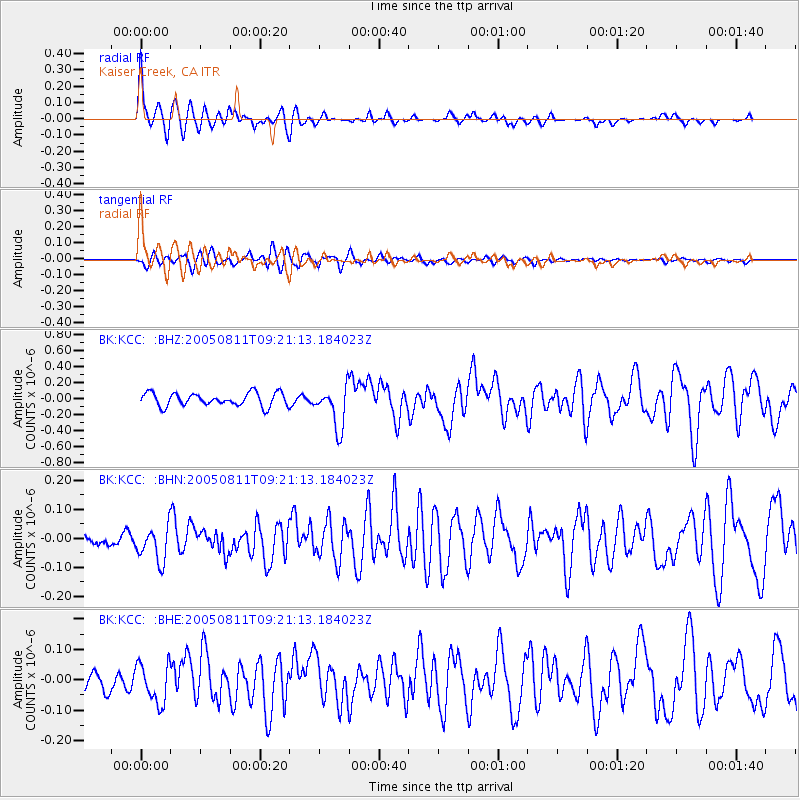
Signal To Noise
| Channel | StoN | STA | LTA |
| BK:KCC: :BHN:20050811T09:21:13.184023Z | 2.317269 | 6.1013175E-8 | 2.6329774E-8 |
| BK:KCC: :BHE:20050811T09:21:13.184023Z | 1.9107522 | 6.514852E-8 | 3.4095745E-8 |
| BK:KCC: :BHZ:20050811T09:21:13.184023Z | 3.2131772 | 2.616495E-7 | 8.1430144E-8 |
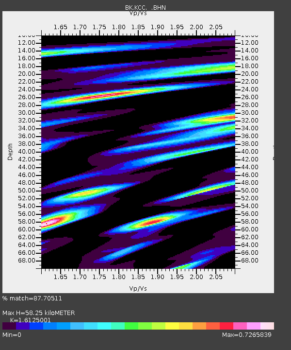
| Arrivals | |
| Ps | 5.8 SECOND |
| PpPs | 24 SECOND |
| PsPs/PpSs | 29 SECOND |

