
KCC Kaiser Creek, CA - Earthquake Result Viewer
| ||||||||||||||||||
| ||||||||||||||||||
| ||||||||||||||||||
|
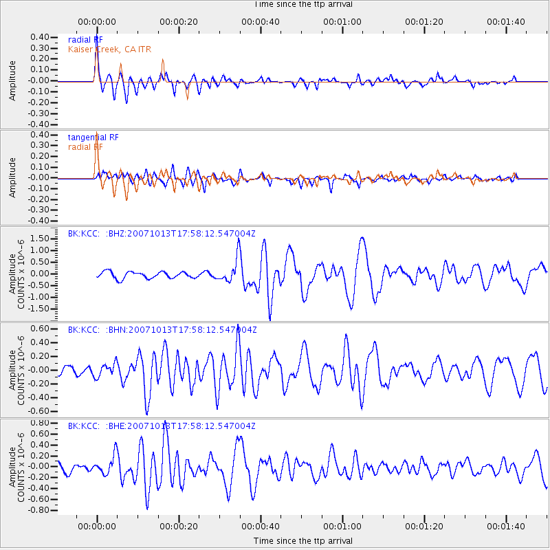
Signal To Noise
| Channel | StoN | STA | LTA |
| BK:KCC: :BHN:20071013T17:58:12.547004Z | 0.87447214 | 9.732784E-8 | 1.1129896E-7 |
| BK:KCC: :BHE:20071013T17:58:12.547004Z | 1.4185872 | 1.784125E-7 | 1.2576774E-7 |
| BK:KCC: :BHZ:20071013T17:58:12.547004Z | 3.7838016 | 5.3737426E-7 | 1.4201967E-7 |
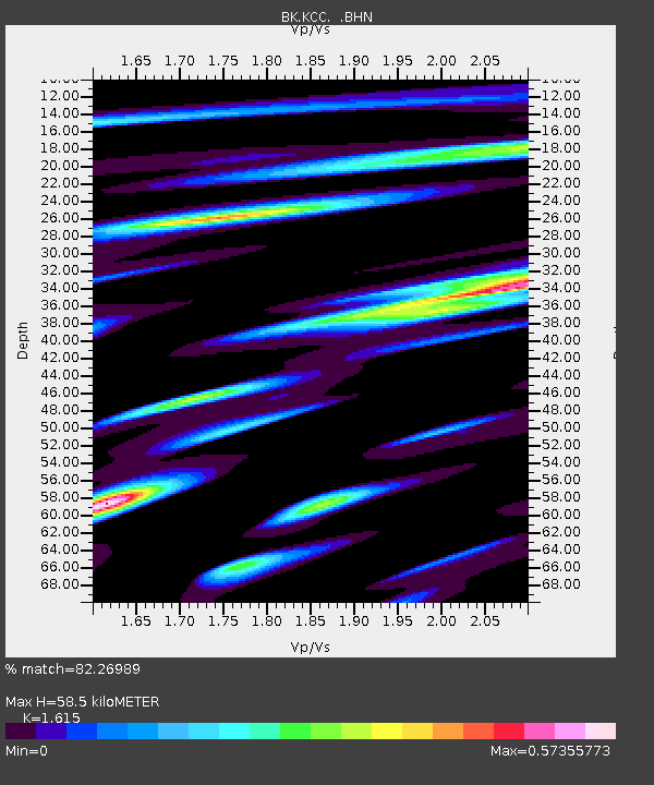
| Arrivals | |
| Ps | 5.8 SECOND |
| PpPs | 24 SECOND |
| PsPs/PpSs | 30 SECOND |

