KCC Kaiser Creek, CA - Earthquake Result Viewer
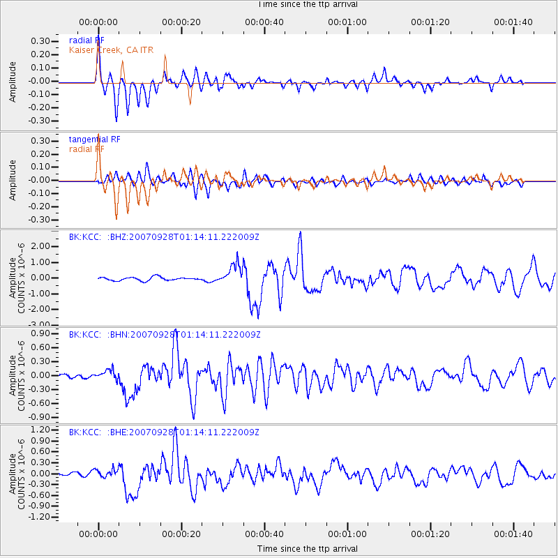
Earthquake location: Southeast Of Loyalty Islands
Earthquake latitude/longitude: -21.2/169.4
Earthquake time(UTC): 2007/09/28 (271) 01:01:48 GMT
Earthquake Depth: 10 km
Earthquake Magnitude: 5.8 MB, 6.4 MS, 6.3 MW, 6.2 MW
Earthquake Catalog/Contributor: WHDF/NEIC
Network: BK Berkeley Digital Seismograph Network
Station: KCC Kaiser Creek, CA
Lat/Lon: 37.32 N/119.32 W
Elevation: 888 m
Distance: 88.8 deg
Az: 49.057 deg
Baz: 242.147 deg
Ray Param: 0.04232479
Estimated Moho Depth: 58.25 km
Estimated Crust Vp/Vs: 1.60
Assumed Crust Vp: 6.291 km/s
Estimated Crust Vs: 3.932 km/s
Estimated Crust Poisson's Ratio: 0.18
Radial Match: 87.53766 %
Radial Bump: 400
Transverse Match: 77.657875 %
Transverse Bump: 400
SOD ConfigId: 2564
Insert Time: 2010-03-05 19:31:42.864 +0000
GWidth: 2.5
Max Bumps: 400
Tol: 0.001

Signal To Noise

ChannelStoNSTALTA
BK:KCC: :BHN:20070928T01:14:11.222009Z1.80152211.0744747E-75.96426E-8
BK:KCC: :BHE:20070928T01:14:11.222009Z2.24851661.14849975E-75.107811E-8
BK:KCC: :BHZ:20070928T01:14:11.222009Z6.2667386.8377847E-71.0911234E-7
Arrivals
Ps5.7 SECOND
PpPs24 SECOND
PsPs/PpSs29 SECOND