KCC Kaiser Creek, CA - Earthquake Result Viewer
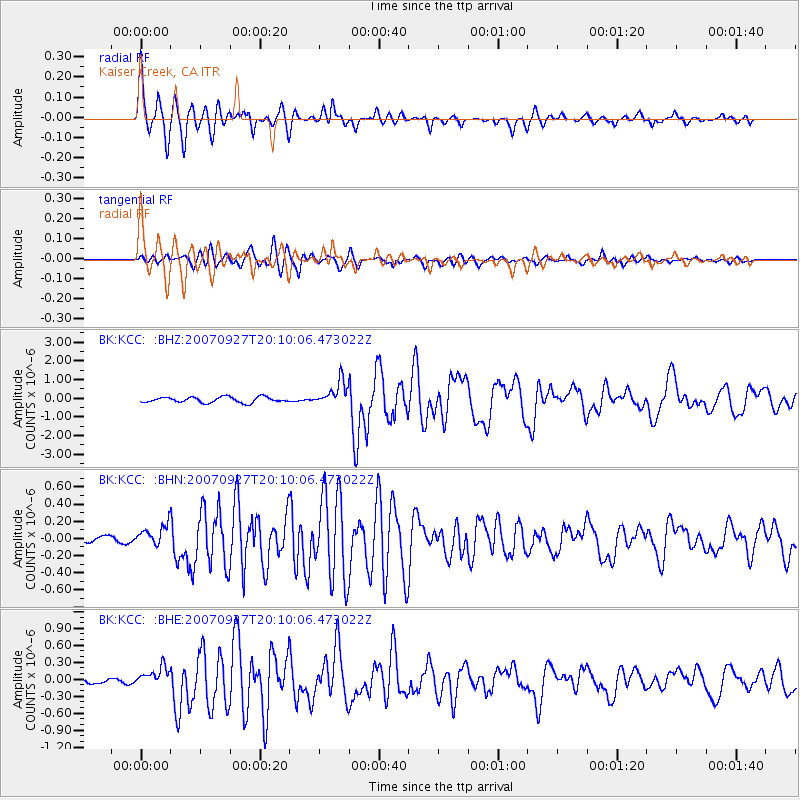
Earthquake location: Southeast Of Loyalty Islands
Earthquake latitude/longitude: -21.1/169.3
Earthquake time(UTC): 2007/09/27 (270) 19:57:44 GMT
Earthquake Depth: 9.0 km
Earthquake Magnitude: 6.2 MB, 6.3 MS, 6.1 MW, 6.1 MW
Earthquake Catalog/Contributor: WHDF/NEIC
Network: BK Berkeley Digital Seismograph Network
Station: KCC Kaiser Creek, CA
Lat/Lon: 37.32 N/119.32 W
Elevation: 888 m
Distance: 88.8 deg
Az: 49.087 deg
Baz: 242.272 deg
Ray Param: 0.04233509
Estimated Moho Depth: 18.75 km
Estimated Crust Vp/Vs: 2.03
Assumed Crust Vp: 6.291 km/s
Estimated Crust Vs: 3.107 km/s
Estimated Crust Poisson's Ratio: 0.34
Radial Match: 88.326775 %
Radial Bump: 400
Transverse Match: 82.87696 %
Transverse Bump: 400
SOD ConfigId: 2564
Insert Time: 2010-03-05 19:31:44.581 +0000
GWidth: 2.5
Max Bumps: 400
Tol: 0.001

Signal To Noise

ChannelStoNSTALTA
BK:KCC: :BHN:20070927T20:10:06.473022Z2.03847671.2663321E-76.212149E-8
BK:KCC: :BHE:20070927T20:10:06.473022Z2.32090381.6845388E-77.258116E-8
BK:KCC: :BHZ:20070927T20:10:06.473022Z4.49855956.584409E-71.4636706E-7
Arrivals
Ps3.1 SECOND
PpPs8.9 SECOND
PsPs/PpSs12 SECOND