
KCC Kaiser Creek, CA - Earthquake Result Viewer
| ||||||||||||||||||
| ||||||||||||||||||
| ||||||||||||||||||
|
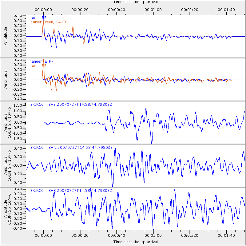
Signal To Noise
| Channel | StoN | STA | LTA |
| BK:KCC: :BHN:20070727T14:58:44.79803Z | 1.7974244 | 7.334161E-8 | 4.0803723E-8 |
| BK:KCC: :BHE:20070727T14:58:44.79803Z | 2.2138247 | 7.223132E-8 | 3.262739E-8 |
| BK:KCC: :BHZ:20070727T14:58:44.79803Z | 3.5597835 | 2.5287355E-7 | 7.103622E-8 |
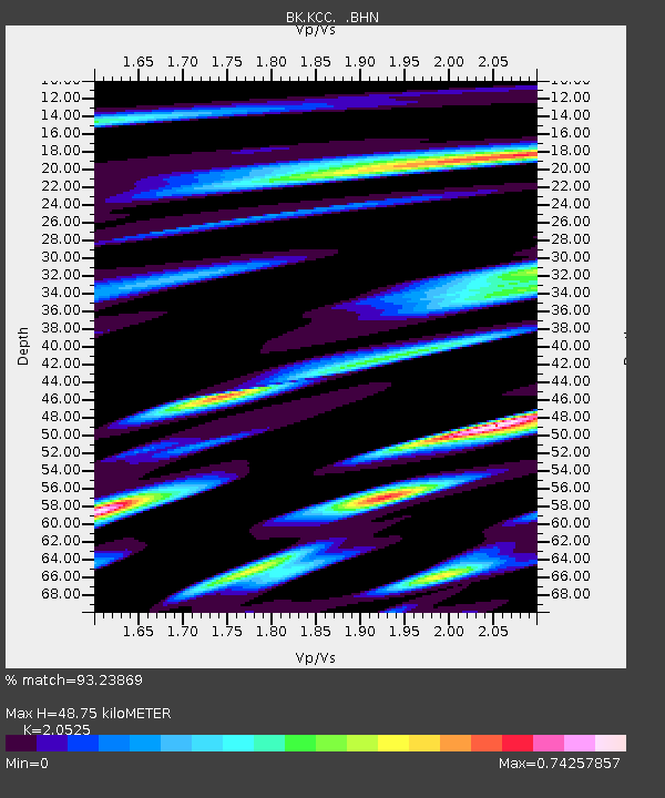
| Arrivals | |
| Ps | 8.3 SECOND |
| PpPs | 23 SECOND |
| PsPs/PpSs | 32 SECOND |

