You are here: Home > Network List > II - Global Seismograph Network (GSN - IRIS/IDA) Stations List
> Station WRAB Tennant Creek, NT, Australia > Earthquake Result Viewer
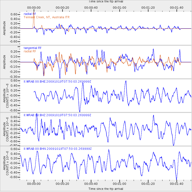
WRAB Tennant Creek, NT, Australia - Earthquake Result Viewer
*The percent match for this event was below the threshold and hence no stack was calculated.
| Earthquake location: |
Samoa Islands Region |
| Earthquake latitude/longitude: |
-15.4/-173.0 |
| Earthquake time(UTC): |
2009/10/19 (292) 07:41:38 GMT |
| Earthquake Depth: |
10 km |
| Earthquake Magnitude: |
5.8 MW, 5.4 MS, 5.4 MB, 5.8 MW |
| Earthquake Catalog/Contributor: |
WHDF/NEIC |
|
| Network: |
II Global Seismograph Network (GSN - IRIS/IDA) |
| Station: |
WRAB Tennant Creek, NT, Australia |
| Lat/Lon: |
19.93 S/134.36 E |
| Elevation: |
366 m |
|
| Distance: |
50.2 deg |
| Az: |
256.767 deg |
| Baz: |
93.779 deg |
| Ray Param: |
$rayparam |
*The percent match for this event was below the threshold and hence was not used in the summary stack. |
|
| Radial Match: |
67.41966 % |
| Radial Bump: |
336 |
| Transverse Match: |
45.716583 % |
| Transverse Bump: |
327 |
| SOD ConfigId: |
1 |
| Insert Time: |
2010-02-19 00:51:46.367 +0000 |
| GWidth: |
2.5 |
| Max Bumps: |
400 |
| Tol: |
0.001 |
|
Signal To Noise
| Channel | StoN | STA | LTA |
| II:WRAB:00:BHZ:20091019T07:50:03.269999Z | 2.6056879 | 3.790192E-7 | 1.454584E-7 |
| II:WRAB:00:BHN:20091019T07:50:03.269999Z | 2.2626514 | 3.5231602E-7 | 1.5570937E-7 |
| II:WRAB:00:BHE:20091019T07:50:03.269999Z | 2.9090757 | 3.8059173E-7 | 1.308291E-7 |
| Arrivals |
| Ps | |
| PpPs | |
| PsPs/PpSs | |


