
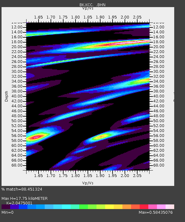
KCC Kaiser Creek, CA - Earthquake Result Viewer
| ||||||||||||||||||
| ||||||||||||||||||
| ||||||||||||||||||
|
Signal To Noise
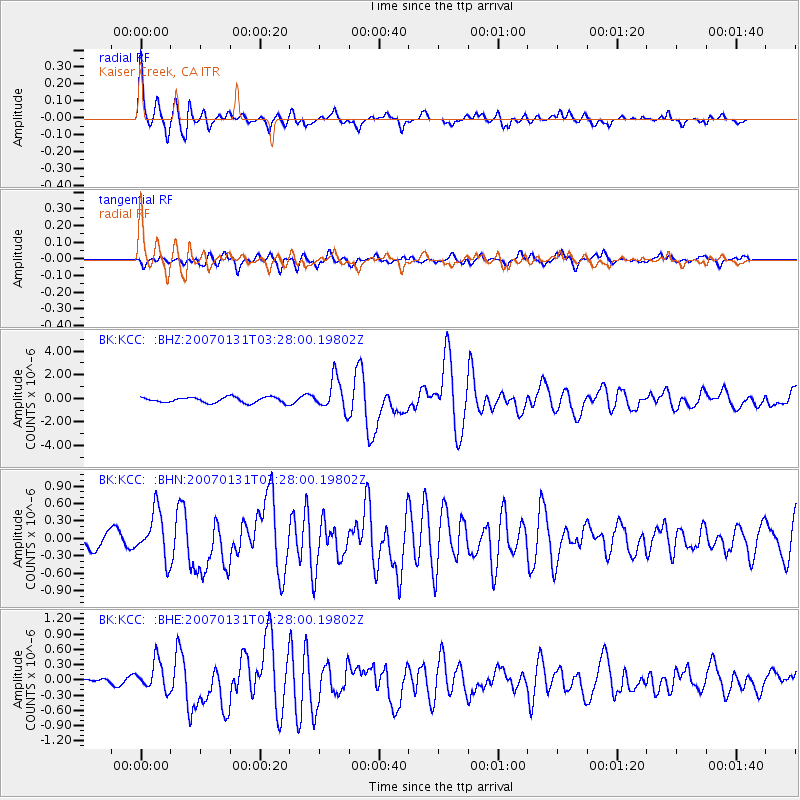
| Channel | StoN | STA | LTA |
| BK:KCC: :BHN:20070131T03:28:00.19802Z | 2.3754413 | 4.0464147E-7 | 1.703437E-7 |
| BK:KCC: :BHE:20070131T03:28:00.19802Z | 3.9613817 | 2.8819105E-7 | 7.275013E-8 |
| BK:KCC: :BHZ:20070131T03:28:00.19802Z | 5.662301 | 1.3405768E-6 | 2.3675477E-7 |
| Arrivals | |
| Ps | 3.0 SECOND |
| PpPs | 8.4 SECOND |
| PsPs/PpSs | 11 SECOND |

