You are here: Home > Network List > CI - Caltech Regional Seismic Network Stations List
> Station TIN Tinemaha, Big Pine, CA, USA > Earthquake Result Viewer
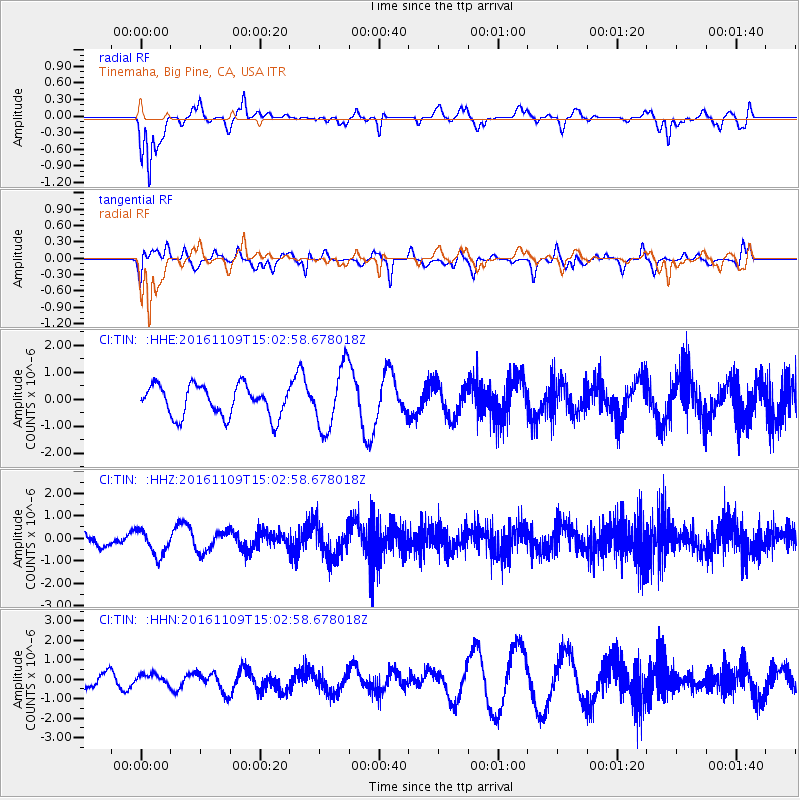
TIN Tinemaha, Big Pine, CA, USA - Earthquake Result Viewer
*The percent match for this event was below the threshold and hence no stack was calculated.
| Earthquake location: |
Bismarck Sea |
| Earthquake latitude/longitude: |
-4.7/149.9 |
| Earthquake time(UTC): |
2016/11/09 (314) 14:50:59 GMT |
| Earthquake Depth: |
446 km |
| Earthquake Magnitude: |
5.9 MWB |
| Earthquake Catalog/Contributor: |
NEIC PDE/NEIC COMCAT |
|
| Network: |
CI Caltech Regional Seismic Network |
| Station: |
TIN Tinemaha, Big Pine, CA, USA |
| Lat/Lon: |
37.05 N/118.23 W |
| Elevation: |
1197 m |
|
| Distance: |
94.3 deg |
| Az: |
53.309 deg |
| Baz: |
267.385 deg |
| Ray Param: |
$rayparam |
*The percent match for this event was below the threshold and hence was not used in the summary stack. |
|
| Radial Match: |
65.63378 % |
| Radial Bump: |
400 |
| Transverse Match: |
61.945995 % |
| Transverse Bump: |
384 |
| SOD ConfigId: |
11737051 |
| Insert Time: |
2019-04-26 00:39:53.571 +0000 |
| GWidth: |
2.5 |
| Max Bumps: |
400 |
| Tol: |
0.001 |
|
Signal To Noise
| Channel | StoN | STA | LTA |
| CI:TIN: :HHZ:20161109T15:02:58.678018Z | 1.7613094 | 5.581175E-7 | 3.1687648E-7 |
| CI:TIN: :HHN:20161109T15:02:58.678018Z | 0.5398423 | 2.6708136E-7 | 4.947396E-7 |
| CI:TIN: :HHE:20161109T15:02:58.678018Z | 2.0550282 | 1.1654267E-6 | 5.6710985E-7 |
| Arrivals |
| Ps | |
| PpPs | |
| PsPs/PpSs | |


