You are here: Home > Network List > TA - USArray Transportable Network (new EarthScope stations) Stations List
> Station R32K Eaglecrest, AK, USA > Earthquake Result Viewer
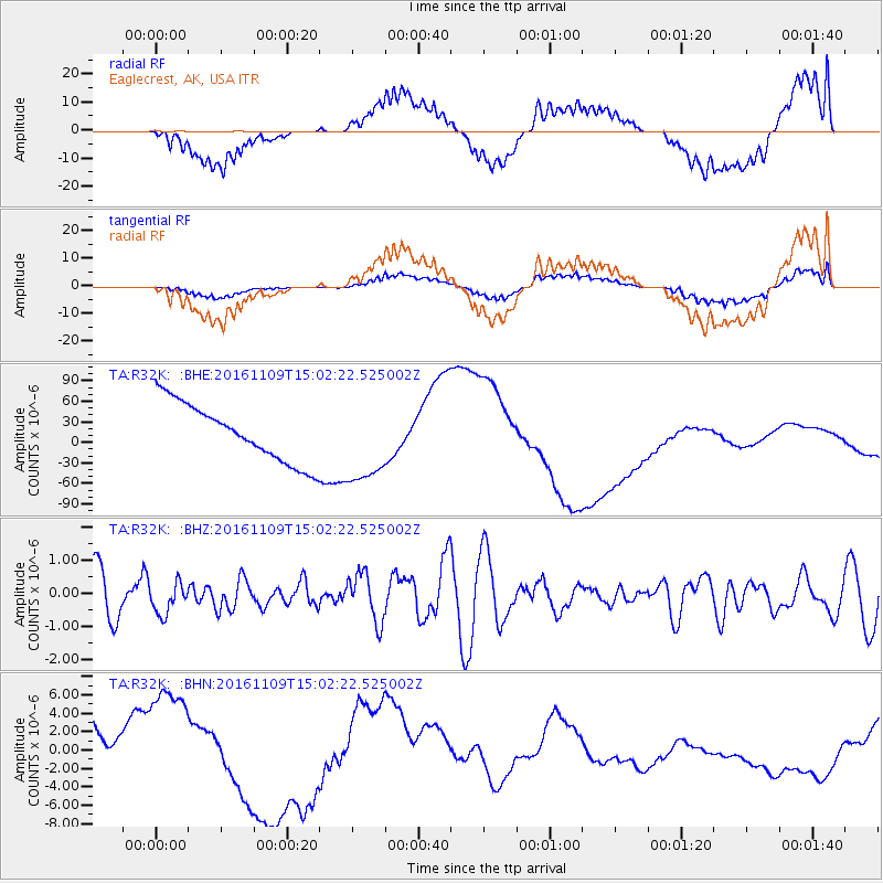
R32K Eaglecrest, AK, USA - Earthquake Result Viewer
*The percent match for this event was below the threshold and hence no stack was calculated.
| Earthquake location: |
Bismarck Sea |
| Earthquake latitude/longitude: |
-4.7/149.9 |
| Earthquake time(UTC): |
2016/11/09 (314) 14:50:59 GMT |
| Earthquake Depth: |
446 km |
| Earthquake Magnitude: |
5.9 MWB |
| Earthquake Catalog/Contributor: |
NEIC PDE/NEIC COMCAT |
|
| Network: |
TA USArray Transportable Network (new EarthScope stations) |
| Station: |
R32K Eaglecrest, AK, USA |
| Lat/Lon: |
58.27 N/134.52 W |
| Elevation: |
386 m |
|
| Distance: |
86.5 deg |
| Az: |
30.853 deg |
| Baz: |
255.301 deg |
| Ray Param: |
$rayparam |
*The percent match for this event was below the threshold and hence was not used in the summary stack. |
|
| Radial Match: |
36.471462 % |
| Radial Bump: |
400 |
| Transverse Match: |
39.296535 % |
| Transverse Bump: |
400 |
| SOD ConfigId: |
11737051 |
| Insert Time: |
2019-04-26 00:42:21.787 +0000 |
| GWidth: |
2.5 |
| Max Bumps: |
400 |
| Tol: |
0.001 |
|
Signal To Noise
| Channel | StoN | STA | LTA |
| TA:R32K: :BHZ:20161109T15:02:22.525002Z | 0.6413508 | 4.7628106E-7 | 7.4262175E-7 |
| TA:R32K: :BHN:20161109T15:02:22.525002Z | 2.000777 | 7.916269E-6 | 3.9565975E-6 |
| TA:R32K: :BHE:20161109T15:02:22.525002Z | 1.4640332 | 6.16912E-5 | 4.2137846E-5 |
| Arrivals |
| Ps | |
| PpPs | |
| PsPs/PpSs | |


