You are here: Home > Network List > TA - USArray Transportable Network (new EarthScope stations) Stations List
> Station R33M Jennings River, BC, CAN > Earthquake Result Viewer
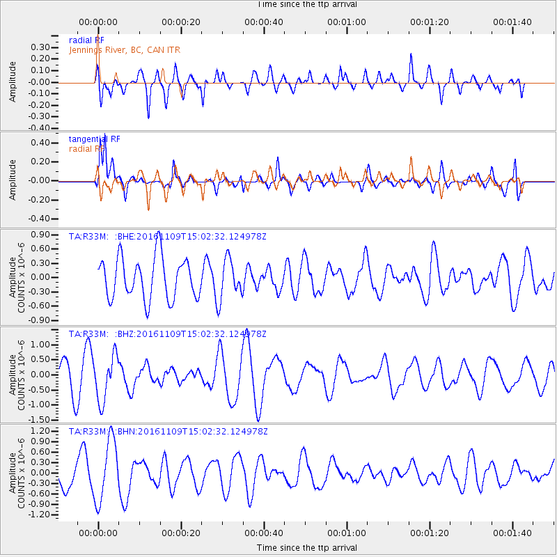
R33M Jennings River, BC, CAN - Earthquake Result Viewer
*The percent match for this event was below the threshold and hence no stack was calculated.
| Earthquake location: |
Bismarck Sea |
| Earthquake latitude/longitude: |
-4.7/149.9 |
| Earthquake time(UTC): |
2016/11/09 (314) 14:50:59 GMT |
| Earthquake Depth: |
446 km |
| Earthquake Magnitude: |
5.9 MWB |
| Earthquake Catalog/Contributor: |
NEIC PDE/NEIC COMCAT |
|
| Network: |
TA USArray Transportable Network (new EarthScope stations) |
| Station: |
R33M Jennings River, BC, CAN |
| Lat/Lon: |
59.39 N/130.97 W |
| Elevation: |
1437 m |
|
| Distance: |
88.5 deg |
| Az: |
30.181 deg |
| Baz: |
258.306 deg |
| Ray Param: |
$rayparam |
*The percent match for this event was below the threshold and hence was not used in the summary stack. |
|
| Radial Match: |
50.859535 % |
| Radial Bump: |
400 |
| Transverse Match: |
75.11474 % |
| Transverse Bump: |
400 |
| SOD ConfigId: |
11737051 |
| Insert Time: |
2019-04-26 00:42:22.604 +0000 |
| GWidth: |
2.5 |
| Max Bumps: |
400 |
| Tol: |
0.001 |
|
Signal To Noise
| Channel | StoN | STA | LTA |
| TA:R33M: :BHZ:20161109T15:02:32.124978Z | 1.2597226 | 7.568899E-7 | 6.008386E-7 |
| TA:R33M: :BHN:20161109T15:02:32.124978Z | 2.3877845 | 9.048604E-7 | 3.7895398E-7 |
| TA:R33M: :BHE:20161109T15:02:32.124978Z | 0.92356837 | 4.0066905E-7 | 4.3382718E-7 |
| Arrivals |
| Ps | |
| PpPs | |
| PsPs/PpSs | |


