
KCC Kaiser Creek, CA - Earthquake Result Viewer
| ||||||||||||||||||
| ||||||||||||||||||
| ||||||||||||||||||
|
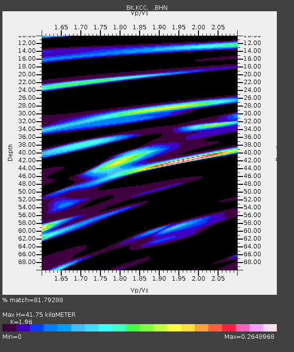
Signal To Noise
| Channel | StoN | STA | LTA |
| BK:KCC: :BHN:20050119T06:22:53.452002Z | 1.6954099 | 1.5212011E-7 | 8.972467E-8 |
| BK:KCC: :BHE:20050119T06:22:53.452002Z | 2.094155 | 3.2781105E-7 | 1.5653619E-7 |
| BK:KCC: :BHZ:20050119T06:22:53.452002Z | 1.7897176 | 3.261323E-7 | 1.8222556E-7 |
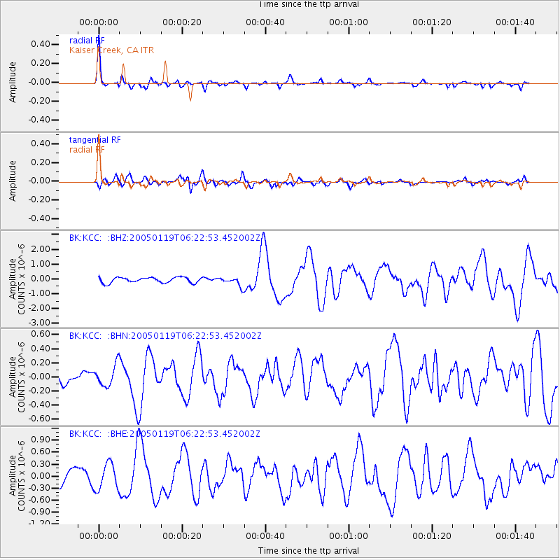
| Arrivals | |
| Ps | 6.5 SECOND |
| PpPs | 19 SECOND |
| PsPs/PpSs | 26 SECOND |

