
KCC Kaiser Creek, CA - Earthquake Result Viewer
| ||||||||||||||||||
| ||||||||||||||||||
| ||||||||||||||||||
|
Signal To Noise
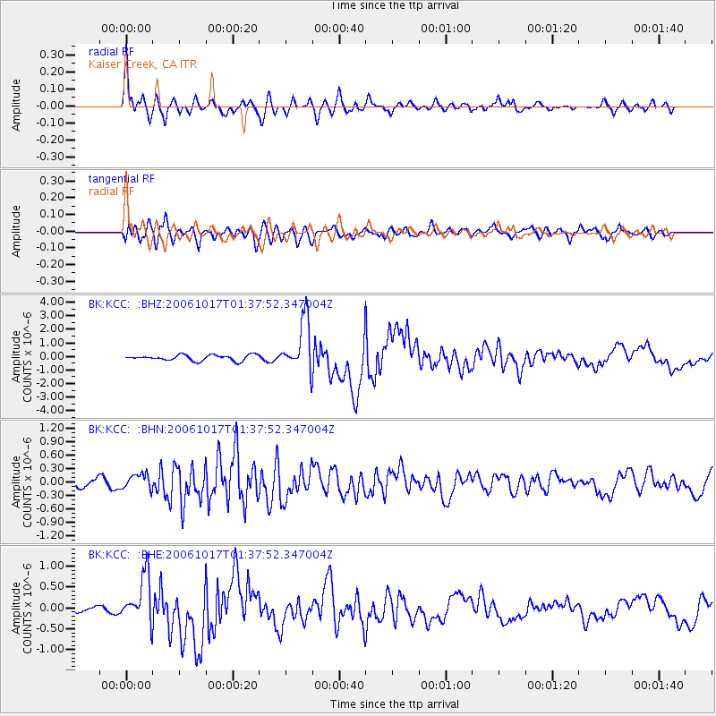
| Channel | StoN | STA | LTA |
| BK:KCC: :BHN:20061017T01:37:52.347004Z | 2.360445 | 1.6874914E-7 | 7.149039E-8 |
| BK:KCC: :BHE:20061017T01:37:52.347004Z | 7.0269904 | 5.7118797E-7 | 8.128487E-8 |
| BK:KCC: :BHZ:20061017T01:37:52.347004Z | 9.19641 | 1.9364873E-6 | 2.105699E-7 |
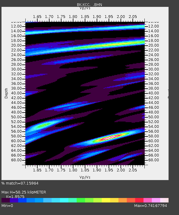
| Arrivals | |
| Ps | 9.0 SECOND |
| PpPs | 27 SECOND |
| PsPs/PpSs | 36 SECOND |

