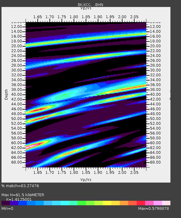
KCC Kaiser Creek, CA - Earthquake Result Viewer
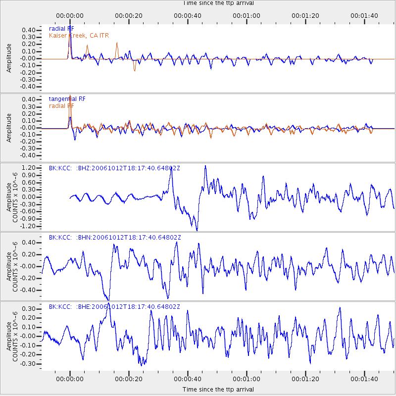
Earthquake location: Near Coast Of Central Chile
Earthquake latitude/longitude: -31.3/-71.3
Earthquake time(UTC): 2006/10/12 (285) 18:05:58 GMT
Earthquake Depth: 46 km
Earthquake Magnitude: 5.8 MB, 6.1 MS, 6.4 MW, 6.3 MW
Earthquake Catalog/Contributor: WHDF/NEIC
Network: BK Berkeley Digital Seismograph Network
Station: KCC Kaiser Creek, CA
Lat/Lon: 37.32 N/119.32 W
Elevation: 888 m
Distance: 81.7 deg
Az: 323.229 deg
Baz: 140.001 deg
Ray Param: 0.047332708
Estimated Moho Depth: 61.5 km
Estimated Crust Vp/Vs: 1.61
Assumed Crust Vp: 6.291 km/s
Estimated Crust Vs: 3.902 km/s
Estimated Crust Poisson's Ratio: 0.19
Radial Match: 83.27476 %
Radial Bump: 400
Transverse Match: 67.655525 %
Transverse Bump: 400
SOD ConfigId: 2665
Insert Time: 2010-03-05 19:33:22.674 +0000
GWidth: 2.5
Max Bumps: 400
Tol: 0.001

Signal To Noise

ChannelStoNSTALTA
BK:KCC: :BHN:20061012T18:17:40.64802Z1.81616091.2288149E-76.7660025E-8
BK:KCC: :BHE:20061012T18:17:40.64802Z1.62615121.0662718E-76.5570276E-8
BK:KCC: :BHZ:20061012T18:17:40.64802Z4.2875834.827217E-71.1258599E-7
Arrivals
Ps6.2 SECOND
PpPs25 SECOND
PsPs/PpSs31 SECOND