
KCC Kaiser Creek, CA - Earthquake Result Viewer
| ||||||||||||||||||
| ||||||||||||||||||
| ||||||||||||||||||
|
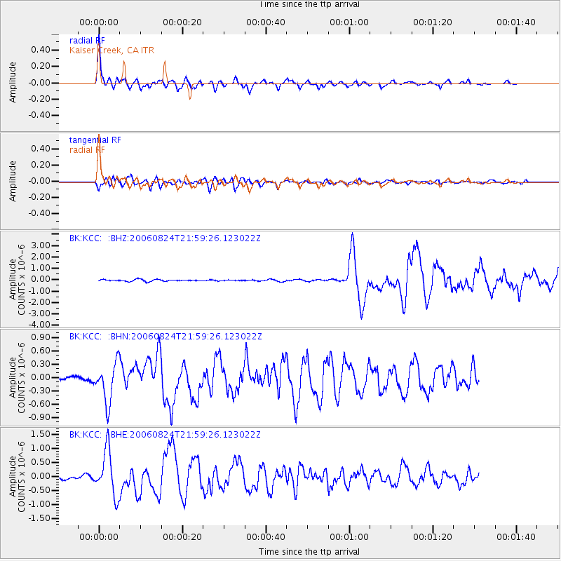
Signal To Noise
| Channel | StoN | STA | LTA |
| BK:KCC: :BHN:20060824T21:59:26.123022Z | 6.2514396 | 4.5623332E-7 | 7.298052E-8 |
| BK:KCC: :BHE:20060824T21:59:26.123022Z | 12.890024 | 8.2545216E-7 | 6.403806E-8 |
| BK:KCC: :BHZ:20060824T21:59:26.123022Z | 31.481201 | 2.0713896E-6 | 6.579767E-8 |
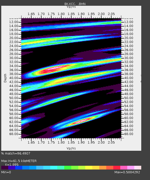
| Arrivals | |
| Ps | 9.1 SECOND |
| PpPs | 27 SECOND |
| PsPs/PpSs | 36 SECOND |

