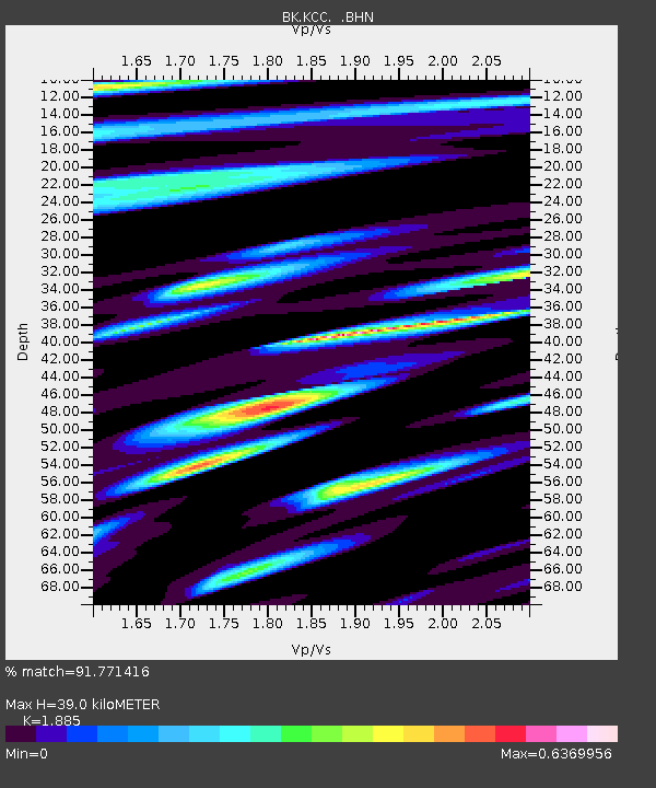
KCC Kaiser Creek, CA - Earthquake Result Viewer
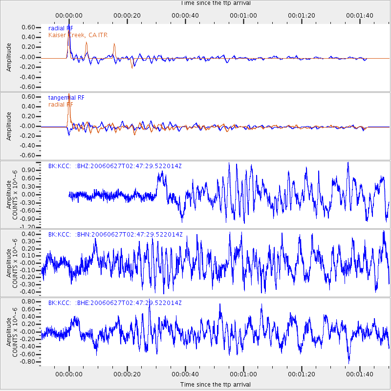
Earthquake location: Rat Islands, Aleutian Islands
Earthquake latitude/longitude: 52.2/176.2
Earthquake time(UTC): 2006/06/27 (178) 02:39:35 GMT
Earthquake Depth: 34 km
Earthquake Magnitude: 5.6 MB, 6.0 MS, 6.2 MW, 6.2 MW
Earthquake Catalog/Contributor: WHDF/NEIC
Network: BK Berkeley Digital Seismograph Network
Station: KCC Kaiser Creek, CA
Lat/Lon: 37.32 N/119.32 W
Elevation: 888 m
Distance: 46.6 deg
Az: 82.008 deg
Baz: 310.139 deg
Ray Param: 0.07047893
Estimated Moho Depth: 39.0 km
Estimated Crust Vp/Vs: 1.88
Assumed Crust Vp: 6.291 km/s
Estimated Crust Vs: 3.338 km/s
Estimated Crust Poisson's Ratio: 0.30
Radial Match: 91.771416 %
Radial Bump: 400
Transverse Match: 79.50371 %
Transverse Bump: 400
SOD ConfigId: 2665
Insert Time: 2010-03-05 19:33:47.549 +0000
GWidth: 2.5
Max Bumps: 400
Tol: 0.001

Signal To Noise

ChannelStoNSTALTA
BK:KCC: :BHN:20060627T02:47:29.522014Z1.48049771.13879516E-77.691975E-8
BK:KCC: :BHE:20060627T02:47:29.522014Z3.32106662.2353814E-76.730914E-8
BK:KCC: :BHZ:20060627T02:47:29.522014Z4.98354964.6391006E-79.308828E-8
Arrivals
Ps5.8 SECOND
PpPs17 SECOND
PsPs/PpSs23 SECOND