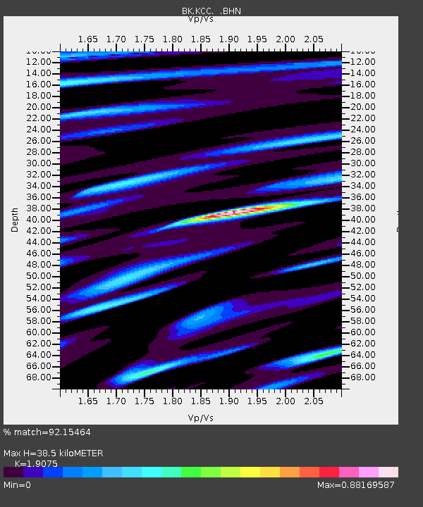
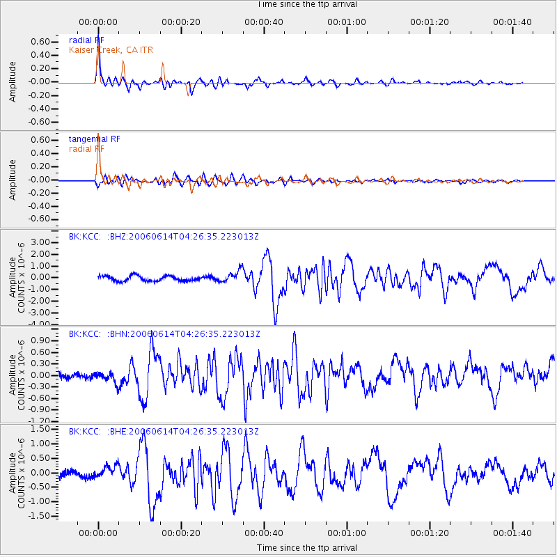
KCC Kaiser Creek, CA - Earthquake Result Viewer

Earthquake location: Rat Islands, Aleutian Islands
Earthquake latitude/longitude: 51.8/177.1
Earthquake time(UTC): 2006/06/14 (165) 04:18:42 GMT
Earthquake Depth: 14 km
Earthquake Magnitude: 5.9 MB, 6.4 MS, 6.4 MW, 6.4 MW
Earthquake Catalog/Contributor: WHDF/NEIC
Network: BK Berkeley Digital Seismograph Network
Station: KCC Kaiser Creek, CA
Lat/Lon: 37.32 N/119.32 W
Elevation: 888 m
Distance: 46.1 deg
Az: 82.213 deg
Baz: 309.413 deg
Ray Param: 0.070836686
Estimated Moho Depth: 38.5 km
Estimated Crust Vp/Vs: 1.91
Assumed Crust Vp: 6.291 km/s
Estimated Crust Vs: 3.298 km/s
Estimated Crust Poisson's Ratio: 0.31
Radial Match: 92.15464 %
Radial Bump: 364
Transverse Match: 81.53093 %
Transverse Bump: 400
SOD ConfigId: 5745
Insert Time: 2010-03-05 19:33:49.001 +0000
GWidth: 2.5
Max Bumps: 400
Tol: 0.001

Signal To Noise

ChannelStoNSTALTA
BK:KCC: :BHN:20060614T04:26:35.223013Z1.48945871.3695077E-79.1946674E-8
BK:KCC: :BHE:20060614T04:26:35.223013Z2.02709872.2406562E-71.1053514E-7
BK:KCC: :BHZ:20060614T04:26:35.223013Z2.43675165.31412E-72.1808215E-7
Arrivals
Ps5.9 SECOND
PpPs17 SECOND
PsPs/PpSs23 SECOND