You are here: Home > Network List > CN - Canadian National Seismograph Network Stations List
> Station FRB IQALUIT, N.W.T. > Earthquake Result Viewer
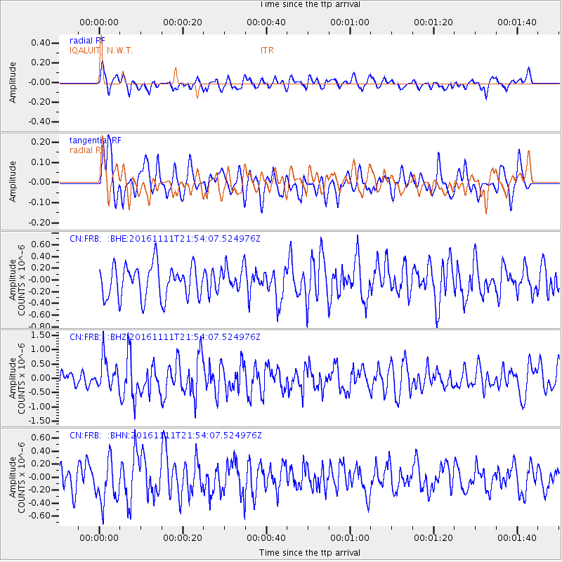
FRB IQALUIT, N.W.T. - Earthquake Result Viewer
*The percent match for this event was below the threshold and hence no stack was calculated.
| Earthquake location: |
Near East Coast Of Honshu, Japan |
| Earthquake latitude/longitude: |
38.5/141.6 |
| Earthquake time(UTC): |
2016/11/11 (316) 21:42:59 GMT |
| Earthquake Depth: |
45 km |
| Earthquake Magnitude: |
6.2 MWB |
| Earthquake Catalog/Contributor: |
NEIC PDE/NEIC COMCAT |
|
| Network: |
CN Canadian National Seismograph Network |
| Station: |
FRB IQALUIT, N.W.T. |
| Lat/Lon: |
63.75 N/68.55 W |
| Elevation: |
18 m |
|
| Distance: |
75.3 deg |
| Az: |
13.333 deg |
| Baz: |
335.991 deg |
| Ray Param: |
$rayparam |
*The percent match for this event was below the threshold and hence was not used in the summary stack. |
|
| Radial Match: |
53.91658 % |
| Radial Bump: |
400 |
| Transverse Match: |
48.793262 % |
| Transverse Bump: |
400 |
| SOD ConfigId: |
11737051 |
| Insert Time: |
2019-04-26 00:54:02.120 +0000 |
| GWidth: |
2.5 |
| Max Bumps: |
400 |
| Tol: |
0.001 |
|
Signal To Noise
| Channel | StoN | STA | LTA |
| CN:FRB: :BHZ:20161111T21:54:07.524976Z | 2.0209985 | 5.360085E-7 | 2.6521963E-7 |
| CN:FRB: :BHN:20161111T21:54:07.524976Z | 1.8669978 | 3.4346013E-7 | 1.8396386E-7 |
| CN:FRB: :BHE:20161111T21:54:07.524976Z | 0.6220078 | 1.7306347E-7 | 2.7823359E-7 |
| Arrivals |
| Ps | |
| PpPs | |
| PsPs/PpSs | |


