KCC Kaiser Creek, CA - Earthquake Result Viewer
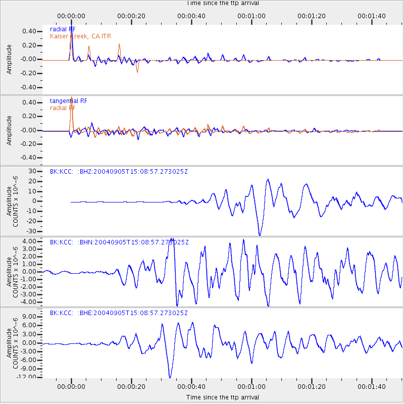
Earthquake location: Near S. Coast Of Honshu, Japan
Earthquake latitude/longitude: 33.2/137.1
Earthquake time(UTC): 2004/09/05 (249) 14:57:18 GMT
Earthquake Depth: 10 km
Earthquake Magnitude: 6.2 MB, 7.1 MS, 7.4 MW, 7.4 MW
Earthquake Catalog/Contributor: WHDF/NEIC
Network: BK Berkeley Digital Seismograph Network
Station: KCC Kaiser Creek, CA
Lat/Lon: 37.32 N/119.32 W
Elevation: 888 m
Distance: 80.1 deg
Az: 51.856 deg
Baz: 304.176 deg
Ray Param: 0.04849359
Estimated Moho Depth: 12.25 km
Estimated Crust Vp/Vs: 2.10
Assumed Crust Vp: 6.291 km/s
Estimated Crust Vs: 2.999 km/s
Estimated Crust Poisson's Ratio: 0.35
Radial Match: 96.49939 %
Radial Bump: 353
Transverse Match: 95.05831 %
Transverse Bump: 400
SOD ConfigId: 124340
Insert Time: 2010-03-05 19:33:53.967 +0000
GWidth: 2.5
Max Bumps: 400
Tol: 0.001

Signal To Noise

ChannelStoNSTALTA
BK:KCC: :BHN:20040905T15:08:57.273025Z0.5580747.702322E-81.3801615E-7
BK:KCC: :BHE:20040905T15:08:57.273025Z0.98990511.4919539E-71.5071684E-7
BK:KCC: :BHZ:20040905T15:08:57.273025Z2.47288013.7857077E-71.53089E-7
Arrivals
Ps2.2 SECOND
PpPs5.9 SECOND
PsPs/PpSs8.1 SECOND