
KCC Kaiser Creek, CA - Earthquake Result Viewer
| ||||||||||||||||||
| ||||||||||||||||||
| ||||||||||||||||||
|
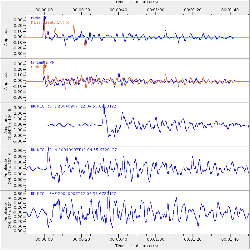
Signal To Noise
| Channel | StoN | STA | LTA |
| BK:KCC: :BHN:20040907T12:04:55.672012Z | 5.0411577 | 4.26949E-7 | 8.469265E-8 |
| BK:KCC: :BHE:20040907T12:04:55.672012Z | 3.327416 | 2.9475214E-7 | 8.85829E-8 |
| BK:KCC: :BHZ:20040907T12:04:55.672012Z | 10.13265 | 1.5304535E-6 | 1.5104176E-7 |
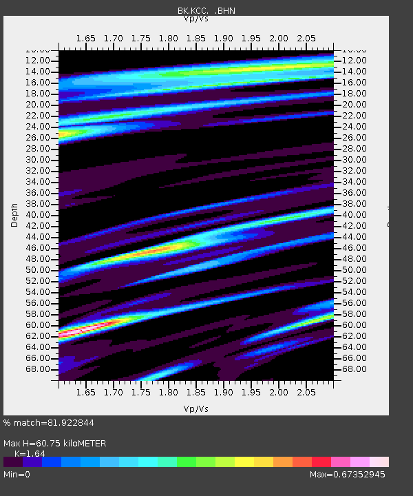
| Arrivals | |
| Ps | 6.4 SECOND |
| PpPs | 25 SECOND |
| PsPs/PpSs | 31 SECOND |

