KCC Kaiser Creek, CA - Earthquake Result Viewer
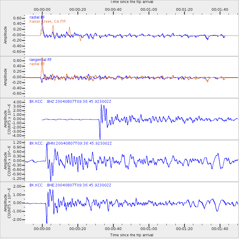
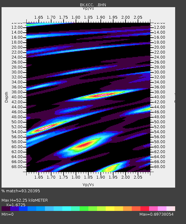
Earthquake location: South Of Aleutian Islands
Earthquake latitude/longitude: 51.8/-166.3
Earthquake time(UTC): 2004/08/07 (220) 09:30:16 GMT
Earthquake Depth: 8.0 km
Earthquake Magnitude: 6.3 MB, 5.4 MS, 6.0 MW, 6.0 MW
Earthquake Catalog/Contributor: WHDF/NEIC
Network: BK Berkeley Digital Seismograph Network
Station: KCC Kaiser Creek, CA
Lat/Lon: 37.32 N/119.32 W
Elevation: 888 m
Distance: 35.8 deg
Az: 94.963 deg
Baz: 309.027 deg
Ray Param: 0.07702526
Estimated Moho Depth: 52.25 km
Estimated Crust Vp/Vs: 1.67
Assumed Crust Vp: 6.291 km/s
Estimated Crust Vs: 3.762 km/s
Estimated Crust Poisson's Ratio: 0.22
Radial Match: 93.28395 %
Radial Bump: 384
Transverse Match: 80.40301 %
Transverse Bump: 400
SOD ConfigId: 2459
Insert Time: 2010-03-05 19:34:20.560 +0000
GWidth: 2.5
Max Bumps: 400
Tol: 0.001

Signal To Noise

ChannelStoNSTALTA
BK:KCC: :BHN:20040807T09:36:45.923002Z12.8567634.7532131E-73.6970526E-8
BK:KCC: :BHE:20040807T09:36:45.923002Z24.7748058.9998696E-73.63267E-8
BK:KCC: :BHZ:20040807T09:36:45.923002Z31.0501731.8115634E-65.83431E-8
Arrivals
Ps6.0 SECOND
PpPs21 SECOND
PsPs/PpSs27 SECOND