You are here: Home > Network List > GS - US Geological Survey Networks Stations List
> Station KAN10 Keim Farm, Anthony, KS, USA > Earthquake Result Viewer
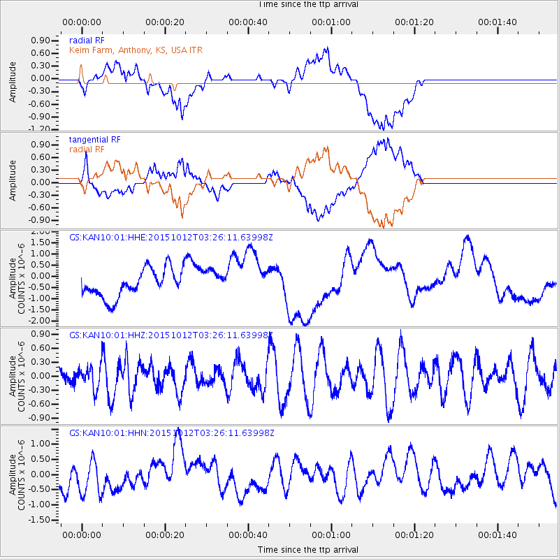
KAN10 Keim Farm, Anthony, KS, USA - Earthquake Result Viewer
*The percent match for this event was below the threshold and hence no stack was calculated.
| Earthquake location: |
Near Coast Of Central Chile |
| Earthquake latitude/longitude: |
-31.2/-71.8 |
| Earthquake time(UTC): |
2015/10/12 (285) 03:15:19 GMT |
| Earthquake Depth: |
21 km |
| Earthquake Magnitude: |
5.6 MWW, 5.3 MWR, 5.5 MWB |
| Earthquake Catalog/Contributor: |
NEIC PDE/NEIC COMCAT |
|
| Network: |
GS US Geological Survey Networks |
| Station: |
KAN10 Keim Farm, Anthony, KS, USA |
| Lat/Lon: |
37.12 N/98.10 W |
| Elevation: |
417 m |
|
| Distance: |
72.3 deg |
| Az: |
338.195 deg |
| Baz: |
156.529 deg |
| Ray Param: |
$rayparam |
*The percent match for this event was below the threshold and hence was not used in the summary stack. |
|
| Radial Match: |
48.313 % |
| Radial Bump: |
400 |
| Transverse Match: |
48.3775 % |
| Transverse Bump: |
400 |
| SOD ConfigId: |
1259291 |
| Insert Time: |
2015-10-29 05:25:16.037 +0000 |
| GWidth: |
2.5 |
| Max Bumps: |
400 |
| Tol: |
0.001 |
|
Signal To Noise
| Channel | StoN | STA | LTA |
| GS:KAN10:01:HHZ:20151012T03:26:11.63998Z | 0.8011006 | 2.4611236E-7 | 3.072178E-7 |
| GS:KAN10:01:HHN:20151012T03:26:11.63998Z | 1.6892189 | 6.641744E-7 | 3.9318434E-7 |
| GS:KAN10:01:HHE:20151012T03:26:11.63998Z | 0.8105754 | 5.033375E-7 | 6.2096325E-7 |
| Arrivals |
| Ps | |
| PpPs | |
| PsPs/PpSs | |


