You are here: Home > Network List > TA - USArray Transportable Network (new EarthScope stations) Stations List
> Station MDND Maddock, ND, USA > Earthquake Result Viewer
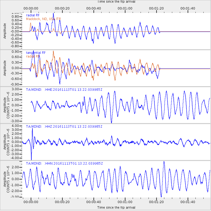
MDND Maddock, ND, USA - Earthquake Result Viewer
*The percent match for this event was below the threshold and hence no stack was calculated.
| Earthquake location: |
La Rioja Province, Argentina |
| Earthquake latitude/longitude: |
-28.1/-67.3 |
| Earthquake time(UTC): |
2016/11/13 (318) 01:01:51 GMT |
| Earthquake Depth: |
121 km |
| Earthquake Magnitude: |
5.7 MB |
| Earthquake Catalog/Contributor: |
NEIC PDE/NEIC COMCAT |
|
| Network: |
TA USArray Transportable Network (new EarthScope stations) |
| Station: |
MDND Maddock, ND, USA |
| Lat/Lon: |
47.85 N/99.60 W |
| Elevation: |
479 m |
|
| Distance: |
81.0 deg |
| Az: |
338.641 deg |
| Baz: |
151.466 deg |
| Ray Param: |
$rayparam |
*The percent match for this event was below the threshold and hence was not used in the summary stack. |
|
| Radial Match: |
56.736286 % |
| Radial Bump: |
332 |
| Transverse Match: |
75.70553 % |
| Transverse Bump: |
377 |
| SOD ConfigId: |
11737051 |
| Insert Time: |
2019-04-26 01:22:38.843 +0000 |
| GWidth: |
2.5 |
| Max Bumps: |
400 |
| Tol: |
0.001 |
|
Signal To Noise
| Channel | StoN | STA | LTA |
| TA:MDND: :HHZ:20161113T01:13:22.039985Z | 6.91753 | 1.4297707E-6 | 2.0668804E-7 |
| TA:MDND: :HHN:20161113T01:13:22.039985Z | 1.4993328 | 1.1667244E-6 | 7.7816236E-7 |
| TA:MDND: :HHE:20161113T01:13:22.039985Z | 1.4475328 | 6.663701E-7 | 4.603489E-7 |
| Arrivals |
| Ps | |
| PpPs | |
| PsPs/PpSs | |


