You are here: Home > Network List > AV - Alaska Volcano Observatory Stations List
> Station MAPS Pakushin Southeast, Makushin Volcano, Alaska > Earthquake Result Viewer
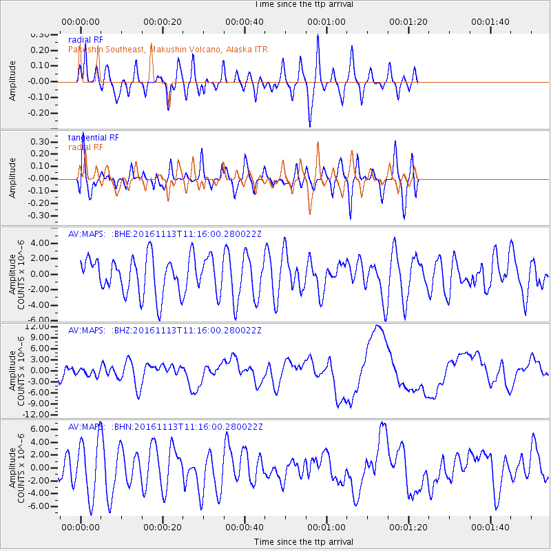
MAPS Pakushin Southeast, Makushin Volcano, Alaska - Earthquake Result Viewer
*The percent match for this event was below the threshold and hence no stack was calculated.
| Earthquake location: |
South Island, New Zealand |
| Earthquake latitude/longitude: |
-42.7/173.1 |
| Earthquake time(UTC): |
2016/11/13 (318) 11:02:59 GMT |
| Earthquake Depth: |
22 km |
| Earthquake Magnitude: |
7.8 MWW, 7.2 MWB, 7.4 MI, 7.8 MWC |
| Earthquake Catalog/Contributor: |
NEIC PDE/NEIC COMCAT |
|
| Network: |
AV Alaska Volcano Observatory |
| Station: |
MAPS Pakushin Southeast, Makushin Volcano, Alaska |
| Lat/Lon: |
53.81 N/166.94 W |
| Elevation: |
333 m |
|
| Distance: |
97.7 deg |
| Az: |
11.808 deg |
| Baz: |
194.729 deg |
| Ray Param: |
$rayparam |
*The percent match for this event was below the threshold and hence was not used in the summary stack. |
|
| Radial Match: |
66.25131 % |
| Radial Bump: |
400 |
| Transverse Match: |
55.944138 % |
| Transverse Bump: |
400 |
| SOD ConfigId: |
11737051 |
| Insert Time: |
2019-04-26 01:25:30.882 +0000 |
| GWidth: |
2.5 |
| Max Bumps: |
400 |
| Tol: |
0.001 |
|
Signal To Noise
| Channel | StoN | STA | LTA |
| AV:MAPS: :BHZ:20161113T11:16:00.280022Z | 0.52884525 | 9.2592916E-7 | 1.7508509E-6 |
| AV:MAPS: :BHN:20161113T11:16:00.280022Z | 2.6007833 | 4.4668213E-6 | 1.7174906E-6 |
| AV:MAPS: :BHE:20161113T11:16:00.280022Z | 0.9649715 | 2.2346437E-6 | 2.3157615E-6 |
| Arrivals |
| Ps | |
| PpPs | |
| PsPs/PpSs | |


