You are here: Home > Network List > CI - Caltech Regional Seismic Network Stations List
> Station MPP McPhearson Peak > Earthquake Result Viewer
MPP McPhearson Peak - Earthquake Result Viewer
*The percent match for this event was below the threshold and hence no stack was calculated.
| Earthquake location: |
South Island, New Zealand |
| Earthquake latitude/longitude: |
-42.3/173.6 |
| Earthquake time(UTC): |
2016/11/13 (318) 11:32:07 GMT |
| Earthquake Depth: |
10 km |
| Earthquake Magnitude: |
6.5 MWW, 7.9 MI |
| Earthquake Catalog/Contributor: |
NEIC PDE/NEIC COMCAT |
|
| Network: |
CI Caltech Regional Seismic Network |
| Station: |
MPP McPhearson Peak |
| Lat/Lon: |
34.89 N/119.81 W |
| Elevation: |
1739 m |
|
| Distance: |
98.0 deg |
| Az: |
49.602 deg |
| Baz: |
223.454 deg |
| Ray Param: |
$rayparam |
*The percent match for this event was below the threshold and hence was not used in the summary stack. |
|
| Radial Match: |
78.592476 % |
| Radial Bump: |
287 |
| Transverse Match: |
69.96221 % |
| Transverse Bump: |
354 |
| SOD ConfigId: |
11737051 |
| Insert Time: |
2019-04-26 01:34:06.500 +0000 |
| GWidth: |
2.5 |
| Max Bumps: |
400 |
| Tol: |
0.001 |
|
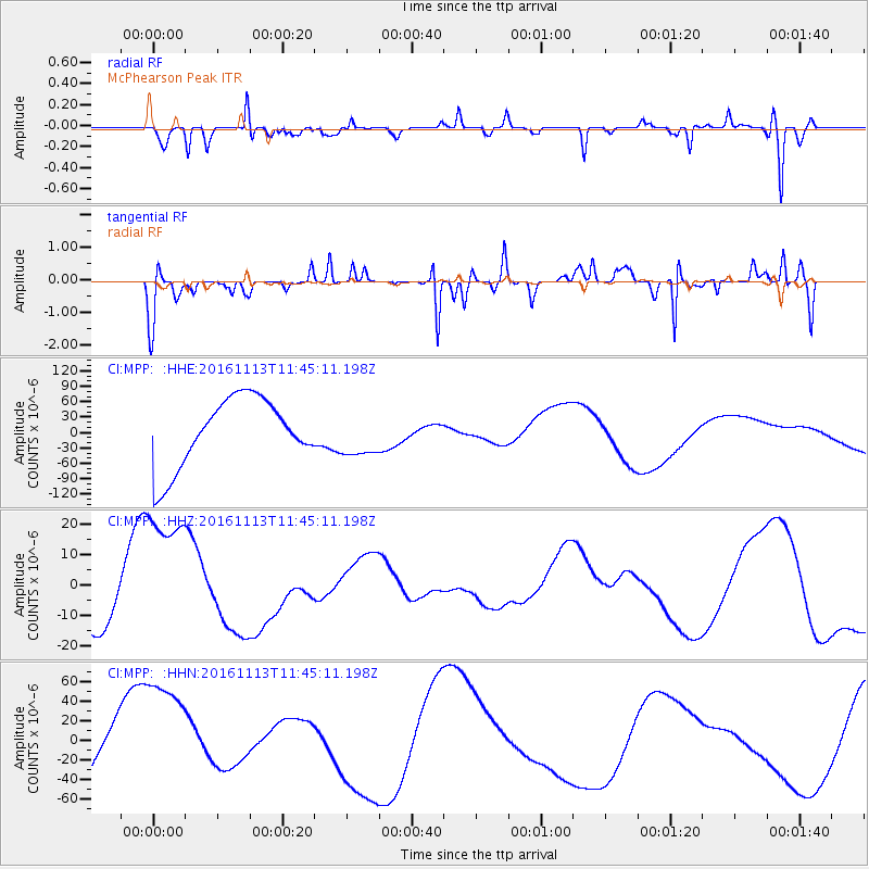
Signal To Noise
| Channel | StoN | STA | LTA |
| CI:MPP: :HHZ:20161113T11:45:11.198Z | 4.2986093 | 2.5328101E-5 | 5.892162E-6 |
| CI:MPP: :HHN:20161113T11:45:11.198Z | 0.9975456 | 6.130355E-5 | 6.145438E-5 |
| CI:MPP: :HHE:20161113T11:45:11.198Z | 0.72305083 | 4.6422854E-5 | 6.4204134E-5 |
| Arrivals |
| Ps | |
| PpPs | |
| PsPs/PpSs | |


