You are here: Home > Network List > GS - US Geological Survey Networks Stations List
> Station KAN11 Stewart Ranch, Harper County, KS, USA > Earthquake Result Viewer
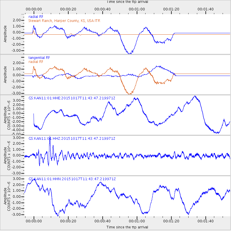
KAN11 Stewart Ranch, Harper County, KS, USA - Earthquake Result Viewer
*The percent match for this event was below the threshold and hence no stack was calculated.
| Earthquake location: |
Salta Province, Argentina |
| Earthquake latitude/longitude: |
-25.4/-64.4 |
| Earthquake time(UTC): |
2015/10/17 (290) 11:33:07 GMT |
| Earthquake Depth: |
8.2 km |
| Earthquake Magnitude: |
6.0 MB, 5.9 MWB |
| Earthquake Catalog/Contributor: |
NEIC PDE/NEIC COMCAT |
|
| Network: |
GS US Geological Survey Networks |
| Station: |
KAN11 Stewart Ranch, Harper County, KS, USA |
| Lat/Lon: |
37.21 N/97.91 W |
| Elevation: |
410 m |
|
| Distance: |
69.8 deg |
| Az: |
332.013 deg |
| Baz: |
147.889 deg |
| Ray Param: |
$rayparam |
*The percent match for this event was below the threshold and hence was not used in the summary stack. |
|
| Radial Match: |
21.060589 % |
| Radial Bump: |
400 |
| Transverse Match: |
10.72932 % |
| Transverse Bump: |
400 |
| SOD ConfigId: |
1259291 |
| Insert Time: |
2015-10-31 12:01:10.471 +0000 |
| GWidth: |
2.5 |
| Max Bumps: |
400 |
| Tol: |
0.001 |
|
Signal To Noise
| Channel | StoN | STA | LTA |
| GS:KAN11:01:HHZ:20151017T11:43:47.219971Z | 4.530205 | 5.373506E-7 | 1.1861509E-7 |
| GS:KAN11:01:HHN:20151017T11:43:47.219971Z | 1.1342565 | 1.9876184E-6 | 1.7523536E-6 |
| GS:KAN11:01:HHE:20151017T11:43:47.219971Z | 0.87700826 | 1.2385013E-6 | 1.412189E-6 |
| Arrivals |
| Ps | |
| PpPs | |
| PsPs/PpSs | |


