MNRC McLaughlin Mine, CA - Earthquake Result Viewer
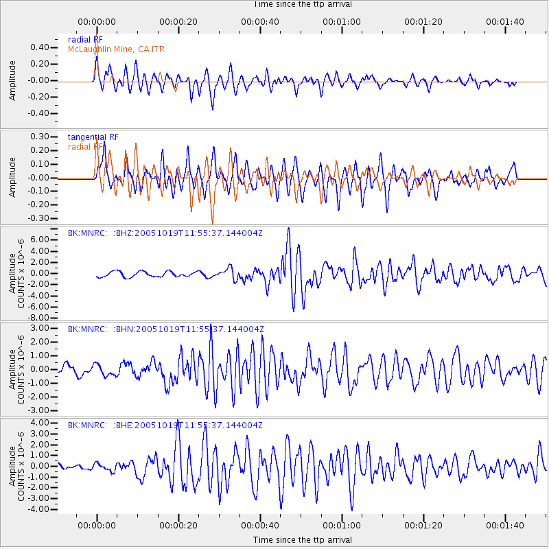
Earthquake location: Near East Coast Of Honshu, Japan
Earthquake latitude/longitude: 36.4/140.8
Earthquake time(UTC): 2005/10/19 (292) 11:44:42 GMT
Earthquake Depth: 32 km
Earthquake Magnitude: 6.2 MB, 6.5 MS, 6.4 MW, 6.3 MW
Earthquake Catalog/Contributor: WHDF/NEIC
Network: BK Berkeley Digital Seismograph Network
Station: MNRC McLaughlin Mine, CA
Lat/Lon: 38.88 N/122.44 W
Elevation: 710 m
Distance: 72.8 deg
Az: 54.239 deg
Baz: 302.996 deg
Ray Param: 0.053377617
Estimated Moho Depth: 22.25 km
Estimated Crust Vp/Vs: 1.90
Assumed Crust Vp: 6.472 km/s
Estimated Crust Vs: 3.402 km/s
Estimated Crust Poisson's Ratio: 0.31
Radial Match: 80.59598 %
Radial Bump: 400
Transverse Match: 79.03579 %
Transverse Bump: 400
SOD ConfigId: 2475
Insert Time: 2010-03-05 19:37:48.465 +0000
GWidth: 2.5
Max Bumps: 400
Tol: 0.001

Signal To Noise

ChannelStoNSTALTA
BK:MNRC: :BHN:20051019T11:55:37.144004Z0.92448594.0475183E-74.3781287E-7
BK:MNRC: :BHE:20051019T11:55:37.144004Z0.80458313.3757877E-74.1956983E-7
BK:MNRC: :BHZ:20051019T11:55:37.144004Z2.06894529.857309E-74.7644133E-7
Arrivals
Ps3.2 SECOND
PpPs9.7 SECOND
PsPs/PpSs13 SECOND