MNRC McLaughlin Mine, CA - Earthquake Result Viewer
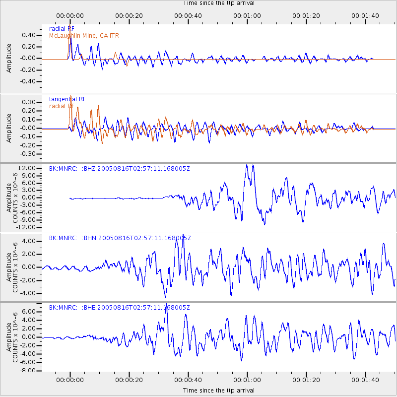
Earthquake location: Near East Coast Of Honshu, Japan
Earthquake latitude/longitude: 38.3/142.0
Earthquake time(UTC): 2005/08/16 (228) 02:46:28 GMT
Earthquake Depth: 36 km
Earthquake Magnitude: 6.5 MB, 6.8 MS, 7.2 MW, 7.1 MW
Earthquake Catalog/Contributor: WHDF/NEIC
Network: BK Berkeley Digital Seismograph Network
Station: MNRC McLaughlin Mine, CA
Lat/Lon: 38.88 N/122.44 W
Elevation: 710 m
Distance: 70.9 deg
Az: 55.283 deg
Baz: 304.02 deg
Ray Param: 0.05459262
Estimated Moho Depth: 24.0 km
Estimated Crust Vp/Vs: 1.74
Assumed Crust Vp: 6.472 km/s
Estimated Crust Vs: 3.725 km/s
Estimated Crust Poisson's Ratio: 0.25
Radial Match: 90.381195 %
Radial Bump: 400
Transverse Match: 78.79257 %
Transverse Bump: 400
SOD ConfigId: 2475
Insert Time: 2010-03-05 19:37:50.973 +0000
GWidth: 2.5
Max Bumps: 400
Tol: 0.001

Signal To Noise

ChannelStoNSTALTA
BK:MNRC: :BHN:20050816T02:57:11.168005Z1.55350092.5609728E-71.6485171E-7
BK:MNRC: :BHE:20050816T02:57:11.168005Z1.35054731.8820415E-71.3935399E-7
BK:MNRC: :BHZ:20050816T02:57:11.168005Z4.6285025.9507204E-71.2856688E-7
Arrivals
Ps2.8 SECOND
PpPs9.8 SECOND
PsPs/PpSs13 SECOND