You are here: Home > Network List > CI - Caltech Regional Seismic Network Stations List
> Station MPP McPhearson Peak > Earthquake Result Viewer
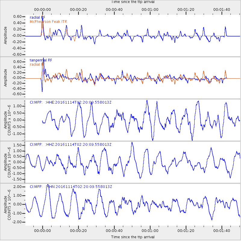
MPP McPhearson Peak - Earthquake Result Viewer
*The percent match for this event was below the threshold and hence no stack was calculated.
| Earthquake location: |
Rat Islands, Aleutian Islands |
| Earthquake latitude/longitude: |
51.1/178.8 |
| Earthquake time(UTC): |
2016/11/14 (319) 02:12:17 GMT |
| Earthquake Depth: |
34 km |
| Earthquake Magnitude: |
5.6 MWW, 5.0 ML, 5.4 ML |
| Earthquake Catalog/Contributor: |
NEIC PDE/NEIC COMCAT |
|
| Network: |
CI Caltech Regional Seismic Network |
| Station: |
MPP McPhearson Peak |
| Lat/Lon: |
34.89 N/119.81 W |
| Elevation: |
1739 m |
|
| Distance: |
46.3 deg |
| Az: |
85.769 deg |
| Baz: |
310.063 deg |
| Ray Param: |
$rayparam |
*The percent match for this event was below the threshold and hence was not used in the summary stack. |
|
| Radial Match: |
44.54022 % |
| Radial Bump: |
340 |
| Transverse Match: |
48.16405 % |
| Transverse Bump: |
400 |
| SOD ConfigId: |
11737051 |
| Insert Time: |
2019-04-26 02:02:13.525 +0000 |
| GWidth: |
2.5 |
| Max Bumps: |
400 |
| Tol: |
0.001 |
|
Signal To Noise
| Channel | StoN | STA | LTA |
| CI:MPP: :HHZ:20161114T02:20:09.558013Z | 0.9482354 | 3.9828188E-7 | 4.200243E-7 |
| CI:MPP: :HHN:20161114T02:20:09.558013Z | 1.8566747 | 1.3476165E-6 | 7.258226E-7 |
| CI:MPP: :HHE:20161114T02:20:09.558013Z | 0.8972987 | 5.4056164E-7 | 6.024322E-7 |
| Arrivals |
| Ps | |
| PpPs | |
| PsPs/PpSs | |


