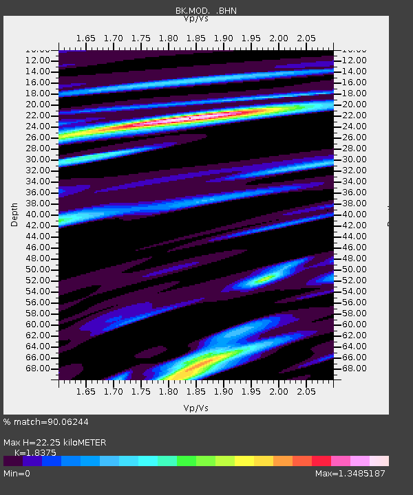
MOD Modoc Plateau, CA - Earthquake Result Viewer
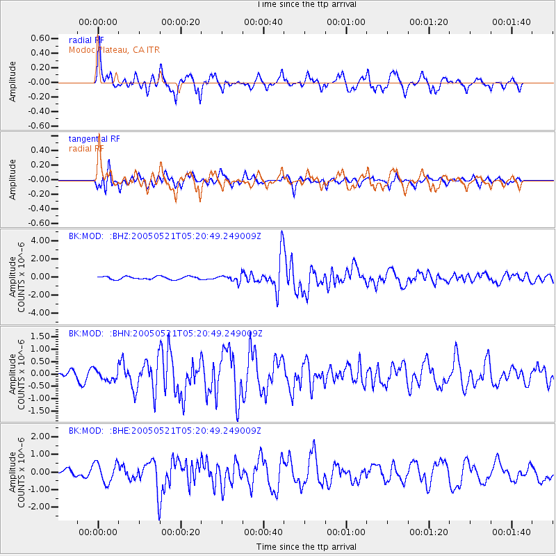
Earthquake location: Peru-Ecuador Border Region
Earthquake latitude/longitude: -3.3/-81.0
Earthquake time(UTC): 2005/05/21 (141) 05:11:35 GMT
Earthquake Depth: 40 km
Earthquake Magnitude: 5.9 MB, 5.9 MS, 6.4 MW, 6.3 MW
Earthquake Catalog/Contributor: WHDF/NEIC
Network: BK Berkeley Digital Seismograph Network
Station: MOD Modoc Plateau, CA
Lat/Lon: 41.90 N/120.30 W
Elevation: 1554 m
Distance: 57.4 deg
Az: 325.846 deg
Baz: 131.337 deg
Ray Param: 0.06343536
Estimated Moho Depth: 22.25 km
Estimated Crust Vp/Vs: 1.84
Assumed Crust Vp: 6.566 km/s
Estimated Crust Vs: 3.573 km/s
Estimated Crust Poisson's Ratio: 0.29
Radial Match: 90.06244 %
Radial Bump: 400
Transverse Match: 51.346573 %
Transverse Bump: 400
SOD ConfigId: 124340
Insert Time: 2010-03-05 19:39:23.664 +0000
GWidth: 2.5
Max Bumps: 400
Tol: 0.001

Signal To Noise

ChannelStoNSTALTA
BK:MOD: :BHN:20050521T05:20:49.249009Z1.45417852.189081E-71.5053729E-7
BK:MOD: :BHE:20050521T05:20:49.249009Z3.8165435.7471857E-71.5058616E-7
BK:MOD: :BHZ:20050521T05:20:49.249009Z2.34735773.818446E-71.6266995E-7
Arrivals
Ps3.0 SECOND
PpPs9.1 SECOND
PsPs/PpSs12 SECOND