
MOD Modoc Plateau, CA - Earthquake Result Viewer
| ||||||||||||||||||
| ||||||||||||||||||
| ||||||||||||||||||
|
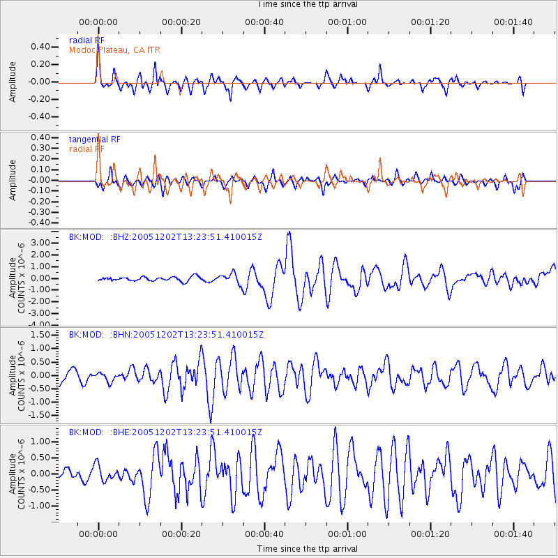
Signal To Noise
| Channel | StoN | STA | LTA |
| BK:MOD: :BHN:20051202T13:23:51.410015Z | 0.65881264 | 1.6592912E-7 | 2.5186088E-7 |
| BK:MOD: :BHE:20051202T13:23:51.410015Z | 0.66319036 | 2.4585503E-7 | 3.7071564E-7 |
| BK:MOD: :BHZ:20051202T13:23:51.410015Z | 2.7742827 | 4.8549174E-7 | 1.7499721E-7 |
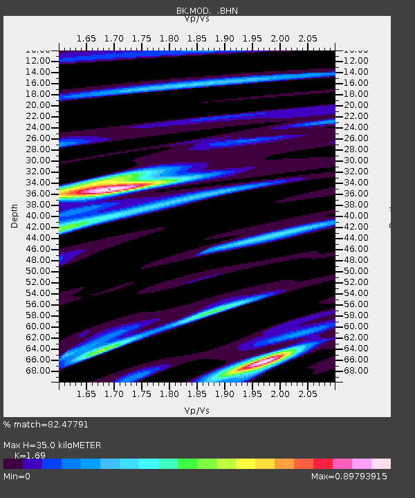
| Arrivals | |
| Ps | 3.8 SECOND |
| PpPs | 14 SECOND |
| PsPs/PpSs | 18 SECOND |

